What is it like climbing Kilimanjaro along the Machame Route

Get a glimpse in to life on Kilimanjaro.

Here is a brutally honest account of Mountaineerins’ 7 day trek along the Machame route to Kilimanjaro.

Written (and un-edited!) by one of our participants, Natalie, it documents the daily highs and lows of life on Kilimanjaro.

It also highlights the amazing guides and porters who are there to support you every step of the way.

We hope it inspires YOU to join us on a trek to Kilimanjaro, the roof of Africa! Enjoy!

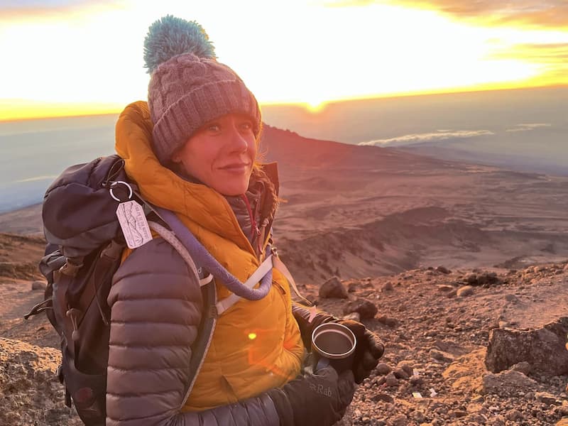
Natalie Holdcroft - Participant Kilimanjaro Jan 2023

Natalies daily blog

Trip: Kilimanjaro Machame Route Trek | Date of trip: January 2023

Participants

  • Simon O – UK Guide from Mountaineerin
  • Pam – UK Guide from Mountaineerin
  • Cameron – Participant
  • Sarah – Participant
  • Toni – Participant
  • Simon K – Participant
  • Lupe – Participant
  • Nat – Participant
  • Rob – Participant
  • Dickson – Local guide
  • Gabriel – Local guide
  • Denbo – Local guide
  • Coleman – Local guide

Day 1 – Arusha to Machame Gate and hike to Machame Camp

We’re on our way to the Machame Gate!

A nice big breakfast and the driver and some of the porters arrive to collect us. We bring down our bags and bid farewell to lovely owners of the homestay and to our roomie Gary the gecko (hoping he hadn’t crawled into any of our bags) – there’s no backing out now…..

A long journey awaits to take us to the Machame Gate. Driving there we go through every type of surrounding it feels like- from shacks to mansions. Driving through the streets of Arusha and Moshi was exciting and enlightening.

A brief toilet and snack shop at a gas station is eventful- being swarmed by locals selling souvenirs. I bought a bar of Cadbury’s whole nut which I shared between the team and porters- like a possible last luxury.

Back on the road and we arrive at the gate. The nerves kick in- this shit just got real. The porters have to get weighed in with our bags so there’s some waiting around which gives us plenty of photo opps! We then sit and have the most amazing lunch- I remember thinking I hope all the food (you know what I’m like with my food) is like this- stuffing what I couldn’t finish in my rucksack – just in case !!! Sarah decided to let Lupe give a haircut using her Swiss Army knife (you’ll learn this is normal Sarah behaviour). We sign in to the national park and we are off!!!!!

The terrain was pleasant, and it was sooooo hot and humid- we are walking through jungle. No monkey sightings like I had hoped…. I had to settle for a lovely chameleon, followed by a few “karma chameleon “ jokes (Cameron).

We arrive at camp

It’s still light when we arrive at camp, nearly 3000m of elevation – machame camp- the sight of the tents = reality and home for the next week.

Things I learned instantly; just because there is a toilet block does not mean they aren’t horrific, stick to YOUR Camp toilet. Also “jambo” means hello. Saying this to the amazing porters (scurrying past you with piles of stuff on their backs and heads to beat you to camp so everything is ready for you)- made me smile so much, so humbling.

All the bag porters were in a line in front of our Mountaineerin hold-alls. We find our bags and introduce ourselves to the amazing person whose job it is to carry your hold-all for the next 7 days. Mine is smiley Shaban!

We unpack, in a fashion, Sarah unpacks her belongings chaotically and everywhere in our tent and proceeds to lose everything too! I’m sharing with Sarah and Toni, the others are all in pairs of 2.

Dinner

Dinner was served in the mess tent, I was instantly impressed instantly. How on earth they get it there and prepare such a feast is just amazing , Dickson brings in the feast; soup, followed by chicken with veg and the most delish mango salad.

Just before we retire for bed. another surprise, Dickson arrived with hot water bottles, JUST AMAZING!! We stuff them into our down jackets and retire to our tent, which was cosy, but a mixture of nerves and adrenaline and tent life and probably already the height we were at meant it was so hard to drop off but eventually must have managed it lol!

Camp toilet antics

I was nervous about getting up in the night for the toilet, but I heard Sarah getting up at midnight so promptly went with her, safety in numbers! It was fine if not for a few authentic bugs in the toilet tent, but anything is better than the sight and smells experienced earlier at the long drop!!

Whilst waiting for her (she faffs at everything- that’s why we love her) I stood and looked at the stars. The clearest sky and the brightest stars… stunning! Then back to bed for some more broken sleep.

Day 2 – Machame Camp to Shira Camp

Ok so you guys know I’m far from a princess…. But that was not a good night’s sleep. I was warm, dry and even the mats surprisingly comfy – I’m guessing it was the over thinking, excitement and constantly deciding if I needed the toilet again and trying to ignore it

We were woken at 6am by a smiling Dickson with hot water to have a drink. We were laughing that it was just all surreal… breakfast at 7am, so Sarah proceeded to empty out the contents of her bag and we laughed as she lost everything 5 times over in the process- if you know you know, lmao!!

All wrapped up we all stumble into the mess tent … it seemed that no one had slept great- to be expected. The amazing feast was porridge then pancakes.

There was peanut butter and then fruit!!! Briefed for the day and ready to leave camp by 8am. The buzz of porters packing down tents and our porters appearing to take our belongings for the day was quite an amazing sight!

Along with Sarah frantically trying to fathom out how to flush the toilet, accompanied by us all laughing and watching (and filming!).

And we were off

Today we were coming out of the jungle and tree line. Simon O and Pam reminding us to look back – wow – the views, just breath-taking.

It all of sudden feels very real and vast although very pleasant. It’s quite warm and very picturesque!

We stop for some food and climb up onto some rocks that they say is a must for the view.

First tears of the day (I was ridiculously teary during this trip) Just wow!! We all took it in turns for photos. Cameron got a corker, wish I’d thought of doing it. Such a missed opportunity.

Back on the road again (so to speak)

The route is a little more craggy and more exposed now but the views just get better and better. It’s our first view of KIBO (the high test peak of Kilimanjaro).

I feel emotional thinking of it another hour or so in, such a blur. I started to feel “ a bit funny”. Jelly legs (confused as my legs can do more than this I tell myself!) then complete dizziness came over me.

Pam sat me down and I had some sweets with one of the guides, Gabriel (the irony I know) watching me, checking I’m ok. Think it was just a bit of low blood sugar. I’m a grazer after all, but it was so sudden it was strange. Take it slow and we go again.

We arrive at Shira camp mid-afternoon

We have the obligatory pics at the camp markers and off to our tents to down rucksacks. With the explanation that mild headaches were normal at this point Simon O and Pam and some of the guides took us on an acclimatisation walk, this is where you walk in for about another half hour, hang about a bit, and then return to camp.

The idea being it tricks your body and when you return lower the headache can ease as the body remembers it’s been at this lower level previously- and we have a great night sleep.

We signed in at the camp- and off we went on the walk. Slow and steady and it was nice not to have your rucksacks on!

Another day and camp reached 

The banter was flying and everyone feeling exhilarated again elevation 3750m Camp looked so different to the previous days, the surroundings, the terrain! But the views as the sun set were stunning.

We washed up for dinner and handed our water bottles in to be filled for the next day! It still amazes me that the water tasted so good – no need for all the potions we had all brought with us, and I still have no idea how on earth they made such amazing quantities and varieties of food.

Tonight’s menu, soup – delish! And pasta with mince, sort of spag bol I guess. We all laugh as Nat is very clear on her thoughts on pasta (cardboard soaked in water ) they won’t have her not eat so made her the biggest mound of rice. Spirits we still high even with altitude fogginess, so wasn’t too bad all round.

A de-briefing for tomorrow happens after dinner

My stomach is flipping. It’s a big day tomorrow – LAVA TOWER long day with lots of elevation. With Head torches and babies (water bottles stuff into our coats) we go off to our tents to get sorted for bed.

There’s something satisfying about brushing your teeth outside in the dark and spitting the froth behind a rock. Good spirits from the team and Walton’s style good nights echo around the campsite

I found drifting off hard and learned quickly that sleeping at altitude was a series of cat naps. I woke about midnight with the call of nature.

Brave enough tonight to go alone- plus Toni and Sarah were spark out lol- I crawled out of the tent- each of the team know exactly what I mean- unattractive drag yourself out like an eel lol

No bugs in the toilet tent- winning! On the way back to our tent – one of my fave memories- I stopped and looked up… the camp silent apart from the odd insect sound, and rustle of trees in the breeze – the sky was the clearest sky of have ever seen and the stars so bright- almost ready to cry again – I didn’t!

I took a deep breathe, took it all in for a few minutes huddling inside my own down jacket for warmth and crawled back into the warmth of the tent JUST MAGICAL!

Day 3 – Shira Camp to Barranco Camp

“Jambo” and then Dickson’ face appears, it’s 6am and our usual morning visitor with hot drinks and a wakeup call. We sit up in our sleeping bags discussing our sleep and the day before getting dressed and making our way to the mess tent.

Today felt more organised – our rucksacks packed the night before, toiletries we needed left out and todays clothes in the bottom of the sleeping bag, so they’re not damp.

We all seemed to wake with mild headaches – not drinking water in the night at altitude brings it on. Nat arose from her tent with a swollen face!!!? With jokes about Denbo having enough of her snoring (if you heard the snores from denbo snoring across camp you’d know this WAS a joke!) or being bitten by a spider- her cheeks and eyelids puffy that we could barely see her eyes- her witty sharp tongue still in full force though!

She chewed down some antihistamines and ibuprofen and crossed her fingers although she felt fine in herself so basked in the temporary sympathy- apparently altitude was the darn culprit again!

Plenty of fluids with breakfast, Sarah trying to decide if she took her malaria tablet twice or not lol! The usual porridge, and today omelette and sausage – mark makes a mountain sandwich with sausage and the omelette (sure he was the only one eating the sausages lol) and the usual fruit.

Pack up and on the path for 8ish…

…with the usual bustle of the porters dismantling home for another night. When all ready they call everyone round and introduce ALL the porters who are involved at some stage in helping us reach the summit, whether that be carrying a tent, cooking, or guiding.

There are about 50 smiling energetic faces in front of us. Thinking of that makes me smile – all so lovely and just absolutely amazing people- physically but also personality wise there’s a real emotion and happy vibe.

Simon O announced that they will now sing for us …. this, it seems it a bit of a tradition. I’d heard a group singing something quirky earlier that morning and felt a little jealous, now it was our turn!

We huddled around, they sang so loud and full of energy- we all filmed and shed a tear- as we now know I now cry at a lot of things up here! It’s so motivating, they actually say “HAKUNA MATATA “ and they work their way through the camps we have and will visit.

Makes you realise how vast this adventure is and we couldn’t do it without them. As Coleman says- ONE TEAM! . You can watch the video here, but it just doesn’t get across what it made us feel that morning!

I watch it often now! They finish, we cheer then Nat jumps in the middle and starts singing and dancing.

And we are off

What a start to day 3 – feeling positive. Early on we were passed by a group of porters playing Bob Marley out of their portable speaker- saying “jambo jambo” and fist bumping us as they passed.

The terrain and vegetation is very different to the previous days- it really feels and looks how I imagine kili would…. Dusty, huge rock formations – we are ascending to lava tower, the highest elevation that we had reached- where we will have a hot lunch (a treat! Apparently packed lunch swapped for this as we were walking so well ) along route dizziness was my friend again, much worse than the day before – not going to lie I was frustrated with feeling so crappy, headache and when I finally had to stop and rest dizziness that wasn’t great when I stood…. Must admit I’m not sure how much was the altitude and how much blood sugar (those who know, know what I’m like with my snacks and being hangry).

Simon O and Pam and Gabriel stood and chatted to be ensuring me there was no rush and how important water was. Eventually after keep having to pause Gabriel asked to help and carry my bag- I felt so guilty and frustrated with myself!!!

He was doing the same as me it didn’t seem far- he said “please let me – it will help you and then you can adjust” – is agreed. It did help loads!!

Lava Tower

I honestly don’t think I could have got to lava tower without his help- I felt so drained- it was such a slow, but weirdly natural pace and so hard…. A few of the group struggling with various things.

Lupe was amazing, staying with me – she went into calming counsellor mode and did some breathing stop it being so shallow and then some distraction to stop me thinking about jt when we actually walked- very technical- counting my steps- simple but actually worked lol. I got to 200 and realised I felt better and stopped counting

Finally after what felt like a day walking lava tower came into view up on our right- wow ! As if I thought the rock formations were cool- well this bad boy- it was a beast!!! With missy and fog coming in – snaking round the rocks- adding to their drama!!

Lava tower is huge rock formation from when kili was more volatile – you can almost imagine the lava flowing down!!!! Just amazing!!!!!!

The elevation

Reaching lava tower was immense- it was by far the hardest day and a number of us hadn’t felt great and was a loooong slog of an ascent – I feel the first real day where you’d really notice the altitude gain and much slower but needed pace!

After cheers and many team pics with the sign – we go into the erected tent for lunch – yep not only were we getting a hot lunch – they had brought the tent, tables etc etc – it really is amazing how they magically do this!!!! All laughing and joking – amazing how for a short while the elation helped us forget the discomfort

After lunch they pack up around us, and we begin descending down towards camp. I had my bag back feeling better, the dizziness gone!

The mist turns into rain. We put our waterproofs on, the terrain was almost Jurassic, huge, strange trees taking years and years to form tower above us. The photos still make me smile- you can really see the scale of them!

The walk down

I found the walk down a little soul destroying as did a few of us- after not feeling great and really pushing through and reaching lava tower it seemed strange to be going back down.

Berranco camp was the same height as the camp the previous night- the idea being we have pushed our bodies to this elevation and wouldn’t be back here for another two days- by this time hopefully more acclimatised and the body remembering it has been here and done it once before – at least this is what we hope for.

It seemed like an age to get to camp, the wet and terrain became a tad tedious, felt like we had been walking forever and made no progress elevation wise. I found it a real head f@*k to be completely honest!

Once again, we were so thankful to see the familiar giant camp sign- we had arrived at Barranco camp… we all, especially me look at little dishevelled! Not great having wet kit and tent. But we got into it and sorted out kit out for the next day and set up for bed and clothes for dinner (no stilettos here – the standard down jacket, camp shoes and head torches!) camp was really foggy and a gorgeous sunset was taking part. Simon O said he’d had the nod from a porter that there was signal on a rock- so off I went to try and contact home (just a quick text).

Yay signal!

I read a gushing surprise text from Rob saying how proud he is already, tears rolled down my face instantly. I missed home, today was tough and I just needed to chat and him say “come on, you’ve got this”. I tried to reply, and nothing would send, signal lost not to return. I had a cry out of frustration!!!

Knowing that he would see the “blue ticks” and I hadn’t replied . I felt really emotional and disappointed. just wanting to have five minutes alone sitting out and watching from the rocks.

I rejoined the team, and we went for dinner. A few of us a bit low with tiredness from the day but also little sleep and headaches from the altitude, in my case I now know not much water and struggled to eat! I know I must not have felt great as I have no pics of food or the night.

I remember mark not eating much as rubbing his head shattered and wanting to go to bed- he usually ate his weight in bread with his soup let alone his main!!we were all a little off in a way. Dinner was deffo quieter than usual.

Early to bed

I remember me and Sarah discussing whether tomorrow was Berranco wall, then sleep in the afternoon with summit night – nearly there.  We were then informed we had it wrong and there was two more days! I literally wanted to cry, I felt crap and it felt like we had made no progress at all that day.

We all went to bed early feeling a little jaded and hoping for a good night sleep and feeling brighter! Tomorrow was the big Barranco wall- what I had spent the last 2 years reading about and googling images, worried about the height and drop. I struggled to get off to sleep as my mind was so active at the thought!

Day 4 – Barranco Camp to Karanga Valley Camp

6am we are woken by the zip on the tent and Dickson peering in with a smile and hot drink for the 2 of us (Toni was always up before the wake up and outside the tent with a drink and morning cigarette lol).

I didn’t sleep great at all, and off the back of not feeling great realised I didn’t drink that much at all the previous day and dinner was a struggle … after not drinking through the night my headache was quite strong (I only usually have headaches when hungry or thirsty) I sipped the water (freezing cold from being in the tent) which annoying felt like brain freeze… I was stressing slightly, and it had normally eased by now.

Off we trotted to breakfast- I really struggled with the food- just didn’t want it we did our stats (blood oxygen and pulse rate) – they were always better in the morning as your body should acclimatise whilst you’re resting.

I planned to put lots of snacks in my bag today to pick at to stop the dizziness in case it was just blood sugar….

I stood by a rock with my rucksack- I remember feeling very overwhelmed and tried to ignore it (the one thing Pam says not to do (wastes way to much energy).

Simon O appeared asking if I had lots of snacks and to eat little and often then asked to check my bag. He said it was too heavy, I didn’t understand as I had only packed what was needed! He went in and took out some clothing (I must admit- extras that “weighed nothing”.

I sat there after he left to tend to others a little frustrated that I had it wrong again… don’t get me wrong this is completely a dramatic response as it was a si Hple conversation of you don’t need these, leave them. I could feel myself trying to not cry!

Sarah came over to me and gave me a hug after asking about my headache – which hurt over my eyes, and I just wanted to close them and go back to sleep.

Tears

As I hugged her, I burst into tears mumbling about my head and I’m tired, Pam obviously spotted, as she sees everything lol and came and took over … well the gates opened, and I sobbed.

Said I felt crap but also felt rubbish cause I was the only one struggling and I was frustrated, it wasn’t fun, and I wanted to go home.

Now for you that know, I am not a quitter, and I am not a I wanna go home person – but I honestly did! She gave me a great talk- people were. Struggling, including her she gave me all the reasons why no way was I going home, said I’d love today- the Barranco wall (which I had actually scared myself reading and googling about ad it looked over the camp- me and Sarah discussing how on earth you get up there ) and how proud everyone back home is and will be along with all the money we had raised for the Birmingham Childrens Hospital (it had just broke to £10k mark as we drove to the machame gate) and I’m here now – so just get it done- my sort of language.

I wiped my eyes – think I felt better for crying about silly stuff! Mark gave me some paracetamol with caffeine in (they worked wonders) I sipped on water. By the time we left I felt much better… maybe some of it was emotional tension and stress?!?

Barranco Wall

And off to Barranco wall we went- it was a steep Rocky quite baron slope, from the bottom looked like no path and looked vertical.

Like with all these things once you get closer and in it you read lose this isn’t quite the case. Single file, we attack the wall.

I have to say I feel like Simon O and Pam really came into their own today encouraging and dropping back and forth and showing us where to put our feet (harder for us shorter ones lol) and then a guide would appear with a hand to help.

Also the fact that, the porters would pass carrying your camp was a reminder to suck it up and carry on. The infamous “kissing rock “is read so much about – you basically huge the rock ‘kissing it ‘to pass by- yes it was tight with little foot room, but I think we just followed each other, and Simon O instructed as he did all the tricky bits, so you didn’t think- I actually only realised what part it was after we’d all completed it!

I feel like we were on the wall 2/3 hours maybe- I may be corrected. Because we were constantly moving, I didn’t really give myself chance to look down to check if I freaked out.

Lupe after reminding me how to breathe and count the previous day checked on me intermittently for not in a fussy way- for which I thought was so lovely, she got some great footage of me on the wall too- mainly showing my legs too short for the chosen route and Simon O just dragging me up via my rucksack lol – and for which I will be forever grateful we were all like one huge family… considering Lupe, Rob, Victoria and Cameron added onto to our group booking – we were one team.

The day was filled with much more of a buzz, Simon and Rob filled a few hours with their “dumb and dumber” quotes which was entertaining to observe, Simon O and Cam chatted football

Top of the wall

We had a little snack and looked around- the view was amazing – the snowy peak getting closer, although it never felt like we were on it just going to it which was odd.

Simon O pointed out where we had come from- the great thing about today was actually (after a dramatic start) you actually start to feel ok with the elevation- or I did I should say, it’s a relatively short day and I ended up really enjoying it.

It was rewarding to look and see the height you’d gained in such a short space of time. The complete opposite to the other days but in particular lava tower.

As we started to walk again and head for camp, terrain more baron and just rocky but relatively flat – I heard Nat say she felt sick, they say her down, I walked past and grabbed her hat and gloves out of her hand (didn’t want to crowd her there’s nothing worse!) as I looked back to say I’d throw them in her tent in camp. She was so sick- like projectile comedy sick- TMI I know but even she was impressed I think not nice but she was with the right people so I left them and re-joined the group.

Photo stop

This was what felt like a short walk to camp. We decided to do the pics of the camp sign later after lunch when we were all together too.

We got sorted and washed up, this time the mess tent split into 2 smaller tents as we had an issue the night before with the cold/rain – resolved swiftly and done seamlessly- like everything else. Just appearing and all sorted!

Nat said she’d been sick a number of times, possible altitude but she was adamant it was Denbos fault- he put electrolytes in her drink, and she only has water- it was just all water.

She was in the other tend to me for lunch- a bit jaded and ate nothing. for those of you that know Nat she loves chips! And the next bit you’ll realise why it’s such a shame for the next bit- in fact she’s still gutted to this day.

CHIPS!

Dickson came into our tent with two huge metal plates- one with a colourful mango an avocado salad and the other one CHIPS!!!

Homemade proper chips, like what your mom used to make in the fryer!! We all threw our hands in the air and cheered!!! And god they were amazing!! I found it frustrating how quickly I got full at altitude!!

Nat went off to bed for a sleep and we dispersed. Most of us went to the Karanga camp sign for the obligatory photos, messing about to see who could get the most interesting or daring photo- a team of porters from another group watched on in amusement. I think Sarah won, a handstand but we basically had to hold her upside down!

A few of us met back up in the mess tent to play cards. This felt like the trips we had had in the U.K. with down time and banter etc rather than food, bed, walk… it was a really nice break in the day. I had forgot about the day before and my morning meltdown and was feeling more positive and had such a strong day, conquering something I’d worried over.

It wasn’t as bad as some on the internet had made out and more importantly, I’d loved it!!! I taught some of the guys cards we used to play on the away coaches back in the day of non-league football physio Ing… it got very competitive with cheering and a little stitching up – usually of mark. Sarah having a king and could took a load out but not realising.

A feast

We were told that dinner would be soon – it felt like there was always food lol. We went for a bit of a chill, wash up, pack the bags for the next day and sort our beds (unroll the sleeping bag and get out ear plugs).

Dinner was another feast- Nat hadn’t been ill again and I gave her some peppermint tea bags. She managed a little bit of soup and food. She then took one to bed along with her baby (hot water bottle) and hoped for a good night sleep.

We all chatted about how we hoped she felt better as she needed to re fuel, and it was quiet without her! Evening stats done along with the debrief- another shorter day tomorrow – all to make you feel great and get ready for the big summit night and day!! The energy (apart from Nat ) was much more lifter as we went off to bed, the sky was so dark and clear.

The stars, god so bright! You could look down and see a million city lights. It makes you think when you’re at the bottom looking up from your hotel room that potentially someone is up there looking back, there were thunder and lightning storms over a few of the towns as we brushed our teeth outside- me and Lupe tried to catch it on camera – not great – but the little fireball you can see in the distance is lightening!!!

Amazing to watch – although I did check it wasn’t on its way up.

Asante Sana

We still weren’t at the elevation that we had been at lava tower…. It started to become clear or the process and for me it was deffo working.

The day, thank god better and better and someone asked me the other day which was my favourite day. Apart from summit day- obviously – it was today!

It started awful and I honestly had had enough in the morning – I just thought I’d this continues then I will feel like death by the time it’s summit day- but trusted the people who are experts, and they were right!

The body is amazing and the route and food along with every other minor detail is planned this way to give you chance to adjust and recover and thankfully my body did this- after a good snotty meltdown!

The wall was my favourite – I just loved it and the chips and games just lifted me further- example of the power of food and friends in tough times!!!

Barranco wall – Asante Sana (thank you very much!) – I bloody loved it!

Day 5 – Karanga Valley Camp to Barafu Camp

Jambao Dickson!! We were used to our wakeup call by now and it is now strangely missed (the tents and lack of showers less so!).

We were prepped for the walk ahead but in our head aware that this evening we would be woke to summit in the early hours….

Pushing the nervous excitement to one side and start looking for another item of Sarah’s that’s she’s misplaced in the tent in the few hours we have been in there sleeping we discuss and compare level of sleep to hours awake and what time we each went to the toilet and if anyone disturbed anyone lmao

The morning, for me, although a slight headache – was so different to the previous two days in a positive way! A few sips of water and it starts to lift already. We come out to breakfast.

Sitting at the breakfast table we learned that Cameron Spence had been ill in the very early hours- sickness and diarrhoea – not gonna lie he looked pale. Nat had another of my peppermint teabags and said they were her saviour and managed a bit of breakfast.

I was sitting next to cam and Sarah, silently thinking what if this isn’t altitude and we are all a struck down by a bug. I pushed this thought and pointless worry to the back of my head and tucked into my porridge, sure Dickson was putting more in each day and I struggled to eat the previous days amount each day. by day 5 I had ditched the peanut butter I was so excited about at the start and Laden the porridge and pancakes with lashings of brown sugar washed down with the sweetest pineapple or juiciest watermelon!!!

Mid way through, Cameron attempted to make a sharp exit out the tent – vomiting on the way out. Simon O went out to tend to him calmly- seriously nothing phases these guys. I tried to ignore what I had just seen- in the nicest way and tried to carry on eating. We noticed that Simon Kirby was looking at him food gingerly and was very quiet- he then informed us he was sick this morning …. He looked weak.

Stats done

And we all split to pack up and get on the path for the day. It still amazes me the strength of Cameron and Simon – they looked awful (sorry guys). Nat looking on the up that they all pushed on. Off we went.

The day currently in my memory is more of a blur than the others, is it because my drama etc was less or is it because in terms of walks etc it’s 2-3 days rolled into one?!? Who knows.

I just remember thinking the terrain is so different again- every day felt like we were somewhere different. The summit had been visible since we left the jungle on day 1 but never felt like we were on the mountain- if you look back at the pics, you’ll hopefully see what I mean- the pics from today I finally felt we were getting closer and it’s looked like we were so close to being on the monster mound dripping in snow we had been photographing!!!!!

The terrain today was crazy- so baron and desert like. Windy and I don’t remember being cold, but we are all so wrapped up (must have blocked that memory out lol) the wind was blowing grit and sand, swirling and you could feel it hitting your face- sharp on the sun and sunburned skin (and yet we used mountain grade factor 50!).

The pace slows

The pace was noticeably slower I felt, but natural, like it was just how we walked at this altitude without thinking. I don’t think I could have walked any quicker and was tough with the rubbish blowing across wind too.

We stopped for a short break and snacks, Cam and Simon, quiet, great that they hadn’t been ill again but just looked like they lacked lustre and just bloody pale… and they weren’t discussing Chelsea and Liverpool.

When we stopped, I felt the energy that was zapped when we were walking and fighting the altitude and sand returned and felt more like my old self. Barranco wall personally fixed me! Lol! Although altitude soon showed you who was boss if you tried to move quickly to go grab something from someone or trot a few paces to get something!! Such an odd feeling!

Back en-route we were chatting about our surroundings – it felt like we were making slow progress and I think it’s cause it was so vast, and you could see so far that there were few landmarks to reach. It felt like we had been dumped in the middle of the dessert.

This beast of a mountain was like no other- the jungle, craggy, giant lava rock formations that felt like the moon, Jurassic like crazy trees that looked like a pineapple mated with a cactus (yep!!! ) to today, the desert!!

Today, I don’t know if it’s the tiredness setting in- day 5 of walking for hours, altitude and broken sleep or the fact some of the team weren’t 100% but it felt quieter and I deffo noticed when walking it was more single file and more in your own head- yes, a team, the best team but having to push yourself and get yourself through.

Barafu Camp

We reach Barafu camp around 1.30pm. The tents felt so much closer together, placed strategically between gaps of rocks… just looked so different!

Very moon like, another strange terrain to the list! We put all our stuff in our tents and went for lunch- amazing again! Soup, a different soup each day and it all tastes so good!

Mark gutted that there’s no bread, he does love soup with his bread it’s entertaining to watch. Nat manages to eat well, and Simon and Cameron still look peaky but manage a small amount of food.

We had veg and potato type fritter/pakoras- they were amazing- although 2 bites and frustratingly I felt full!!! Simon took our stats, him and Pam calm the room without knowing.

Simon took Cameron outside and then Cam returned and then he called Simon, they were obviously discussing how they were – I felt worried for them – what if they were being told they could go no further- they returned and informed us they were going on, they had answered the critical questions appropriately and they had a plan. Sitting in the heat of the mess tent the view from either end felt like we had landed on the moon, rock and mist/dust/cloud, who knows,  were all we could see, surreal!

Unfortunately, the helipad (every camp had one) was in use – whilst eating and chatting we heard it landing and looked out and saw porters carrying who looked like another porter in a makeshift stretcher.

I turned away not wanting to see more, not wanting to know or see more, the helicopter isn’t good news on a mountain!

Pep Talk

We were asked to meet out on the rocks to discuss the night. Simon chatted briefly…. And handed it over to guys from Tanzania to explain- they begin with congratulating us- to reach Barafu camp we have all proved we are strong and able to attempt to summit tonight- this felt amazing to hear- these guys who are superhuman, who have done these droid times telling us we are strong!!!!

The 3 guys took it in turns to discuss what to expect, from temperature and kit, terrain and what happens if we aren’t well.

All of a sudden this felt very real- I had butterflies listening … this was serious. It’s all a little blur. I remember them discussing how to stop our water freezing by putting bottles in socks or blocking back into the tube of our camel packs … along with IF it was needed, we would leave the rest of the group and one of the team will bring us down and we wait back at camp.

I remember asking Simon, can we attempt again, or just one shot. That’s it in my head, this is happening. All these days of ups and downs there’s no way I’m not standing at the top and I want the whole team with me and I’m sure every single other person felt the same!

Summit ready

Porters would stay at camp and sleep with our belongings (holdalls) to keep them safe and the ones who could guide would come with us… It was more that 1:1 if I remember rightly.

About 3pm and we get sent to prep, chill, and maybe sleep. I packed my “summit “ motivation note off Eleri into my rucksack- they had become part of our morning ritual , and sharing its content with members of the team.

The tent was so hot in the mid-afternoon heat- so strange that it’s hot and cold at the same time!! I put an eye mask on and try to dose but I just couldn’t – filled with adrenaline and my mind racing and just awake as it was mid-afternoon.

I did take a few pics of Sarah – she amused me how she has fell asleep- look like a sniper had got her and then blindfolded her, Our alarm was set for 5pm for dinner- I have no pics of food or the rest of the night- think I was in serious mode!!!

Excitement or panic?

I went to the camp toilet tent, looked at my phone and saw I had signal. It’s such a moment when you realise, like excitement and panic. A message pinged through from Rob (asking for their group text of partners) if everyone was ok.

I didn’t think it fair to mention Simon, I know if it was me I wouldn’t want Rob to worry and didn’t want Simon’s wife to do the same. I messaged Rob saying we were all fine, I said I was scared, the helicopter was now on its third landing in as many hours!

I made a joke about sitting on the loo (who says romance is dead) but to be fair considering you’re on one of the biggest mountain in the world privacy is sparce as the landscape. So the loo was a handy space lol and just like that signal gone, so bloody frustrating but happy that one message had sent.

I trot off to the mess tent where we all eat, there’s an air of tension not with each other just I think nervous energy about the night to come . Cameron and Simon managed to eat a little , and just like that Dickson brought in our “hot babies” and we went off to bed.

Camp had a very different vibe as we packed ourselves off for the night. It was around 7pm and we were going to be woken at 11pm, hot drink, snack and hoping to start heading for the summit in the dead of night at 12/12.30am , the anticipation was palpable!

I remember saying to Sarah, can you believe we are here, now, summit night, we are going to do this. I asked her if she was scared, I took comfort that she said yep- me too! Bloody love this group. we have got this! 

HAKUNA MATATA!

I tossed and turned for nearly two hours getting stressed that I knew I needed to sleep, I dragged myself out the tent- not even as graceful as an eel(we had stupidly stacked all the bags in front of the door as we thought we were only in there a few hours so couldn’t possibly need the loo ).

I went out into the biting cold of the night for a token wee and settled much better and managed to drift off…

Day 6 – Baradu Camp to Uhuru Peak

I’m not sure how much sleep we had, personally I felt like about 2 hours and the Dickson appeared. Not the usual 6am wake up- bizarrely 11pm.

The instant realisation that the night/day of what all this was for was here. It had an air of seriousness about it. Me, Sarah, and Toni sat up in the tent in our down bags, it felt cold and started getting ready. Bizarrely we could hear music, listening harder…. “Don’t worry, about a thing, cause every little thing is gonna be alright” sounds of bob Marley filled the tent.

Intrigued I poked my head out the tents where the porters slept had a little cluster of lights in the pitch black of the night with the sound of this coming from it … it made me smile, soothing in a weird way. We got ready for night and day and made our way to the mess tent for a drink, snack, and stats.

The tent was chatty but more so with nervous energy. I asked how Simon Kirby and Cameron Spence were feeling Cameron seemed perkier but not right, Simon still looked weak and was quiet.

He told me he would do his best for me and our team, I felt awful – it’s not about us – you do the best for you , no pressure but you have got this. I didn’t know whether to go hard and be like you have got this or soft and more you’ve got this far it’s an achievement (which of course it is!)

With our leaders Simon and Pamela happy, we left the tent for our rucksack and met in the corner of the campsite ready to go. I can feel the butterflies just thinking about it.

I had read Eleri’s card – dig deep, take in the sunrise and views, if I’m struggling, 20 steps and rest for 10. That sounds bizarre I know but honestly the pace! Humphrey felt my bag and said it was heavy, he took my two water bottles with my bed socks over them and put them in his bag to lighten the load, along with our charity flags for the summit.

He would keep them safe. He wrapped them around his body and zipped up his jacket. What they do is just amazing, they just want you to reach the top so much you can feel it .

Off we started

Single file, poles out, head torches on with Simon and Cameron at the front with the guide, Simon and Pam dotted in line – strategically placed, I’m sure. The other guides dotted about.

It was about 12.30am, Simon said not to look at our watches so I didn’t. I wouldn’t let myself! I didn’t want it to be soul destroying, this is it, enjoy what you can, be present and dig deep, I told myself. I felt surprisingly good, no headache, no aches, blisters , sickness. Fingers crossed it stays this way.

The first bit was a bit rockier and steeper out of camp than previous days, for obvious reasons and I’m sure the dark intensifies this.

We were told it’s steep, rocky and then after a while less so and then we zig zag up until we get to stella point, then a short walk from there around the crater rim to uhuru peak. The rooftop of Kilimanjaro, of Africa!

I WILL BE STANDING THERE! WE WILL ALL BE THERE!

The pace was slow and the group relatively quiet. You can see other groups doing the same walk at different stages as you see the little lights of clusters of headlamps moving across the black backdrop of the sky.

The nice thing was you could see nothing else, nothing to dread or fear on a way. Just one foot in front of the other and I have no timescale of how long until we reached the “zig zags”.

When we reached the zig zag path it felt like progress, tick, we have done the first bit, Simon and Cameron were doing great as were the rest of the group.

Toilet break was amazing, off me Lupe, Nat and I think Sarah trotted and almost huddled together in the dark to go it felt like it was getting colder. I suppose we are getting higher and it’s getting more into the early hours, I had all of my clothes on pretty much, I felt so bunched up and just had the waterproof in my bag. Thermal leggings, walking trousers and waterproofs and on top thermal base, long sleeve top, t shirt, fleece, down jacket and down gillet and then thermal buff and bobble had; like Joey wearing all of chandler’s clothes in friends. We did quite the line “could I

Be wearing any more clothes a few times”. The last layer outcome the big daddy gloves to go over my thinner pair- Humphrey helped me put them on. I remember looking at some of the guides – no gloves!!!!

Mood change

It’s strange, the terrain didn’t change then, nothing really was said, we just walked, paused and walked, everyone having their own battles. There are things I remember that happened but is that because not much else did, for hours!!!

I remember one of the guides whispering we were halfway, “yes, same again and we are done”, this is how I work when I train, and it totally helps to push me. I remember telling Victoria Brewster this and she was distraught, is that all, I felt bad, I thought it would help her!!! I kept it to myself after that. We paused and I needed the toilet AGAIN, you care less and less about carefully picking a spot. There will do! It was difficult with the layers and my fingers becoming useless. I managed and manage to get my thermals up, but struggled so got dressed by two porters after then like a child.

The next landmark

Breaking the slow gruelling pace- which felt like army torture, you know, something you see in SAS who dares wins, was that the mountain in front of us in the distance was turning orange.

Not long now and the sun would rise. I thought it was already beautiful, illuminating the base of the mountain. I remember Simon saying he anticipated we be at Stella point for sunrise- yes!!!! We can’t be far!

A couple more zig zags and we all halted, the sun rose in front of our eyes. I think we all got emotional. I cried, it was in amazement of what I was seeing but also what I was doing.

A realisation that I was summiting Mt Kilimanjaro and as the sun rose, like nothing I have ever seen or experienced and sadly possibly never will again. But I felt like it was rising beneath and around me, just spectacular. Like magic, as always Dickson appeared handing out mugs and filling them with hot water from flasks!

This guy! Hot water has never been so good, thawing out everything. And warming me up. Humphrey had asked for my phone when he knew the sun was rising. I’m forever grateful! For someone who takes a million pics I had no inclination to go through my million layers to find it and try and take a pic with my gloves on!!

These photos he has took are possibly my favourite of the whole trip- exclusive to us- our sun rise …. Everyone has seen the famous summit sign. He took a video, not only capturing the sky but everyone’s mood and emotion, I look like I am excited, happy, and crying – purely overwhelmed!

Digging deep

Mugs away and able to see the path a little now we continue on. We fall back in line. Mark is in front of me- he has his earphones in, quite funny but I remember his shouting “his heart was beating out of his chest” not realising he was shouting cause of the earphones he was in the zone.

His walking looked more laboured now and the slow speed taking its toll. I remember feeling great and talking to myself but equally breathing was still difficult, not able to fill your lungs properly- and was thankful for a rest every time someone paused.

I remember him stopping and trying to be sick, Pam slid in and we just passed him- I loved how there was never a panic or drama- it keeps things moving and calm- he wasn’t sick, he said it wouldn’t come he powered on, digging deep.

I remember thinking we must be near to Stella point. – the sun has come up and the zig zags kept coming, and the top never seemed to come – much worse when you can see.

Then almost in no time we approached Stella point- annoyingly the same sign as uhuru but with different words. We were there I think pretty much as a team. For a second, I thought it was uhuru and wondered if I’d missed Stella point- funny as I’ve read every kili book and I know what the drill is- but your mind plays tricks!!!

We had some photos and then started to move. The terrain was completely open and vast- you looked across the crater rim and you can see glaciers and in the distance the outline of the uhuru peak sign- it’s just there- let’s go! We seemed to disperse in this bit – each on a mission, having to dig deep and get through.

I don’t remember who was where, except Sarah was Infront of me – with a guide- I couldn’t see who. John was with me most the way I think at this point. Asking if he needed to take my bag, no I felt strong – it was just there!! And like a wave then you’d have to pause- it was exhausting but I am beyond proud of how I pushed myself mentally- almost talking and pushing myself. I imagined runs and how I felt at the end, I imagined calling everyone when I got down and saying I’d done it, imagined being at the top…. I remember him saying “pole pole (slowly slowly) you can do this you are strong. At one point I remember replying “I AM strong! .

Sarah was ahead of me still I felt lasting and like I’d catch her and be able to walk together but you feel like you’re treading water and can’t physically move any faster.

This was a solo effort- the last push and then we celebrate as a team. You’re so unaware of anything other than yourself and what’s immediately in front of you- I had no concept of where everyone else was…I saw two porters helping a man- normally that would worry me but I kind of noticed but moved on – awful really and I hope he’s ok- but

I was focusing on just getting to the top and no negativity or doubt was getting in- or I was deleterious and didn’t quite comprehend what I saw!

So I remember ranting and thinking – Simon this is NOT flat, feeling ever little incline and getting slower and having to pause more to try and get more air in. I’d love to see the elevation of that 45mins – it probably was flattish, and it was good old altitude again.

We are there!

Then almost all of a sudden, we were there- delirious and hugging each team member and porter. It didn’t feel like that was it, it was a strange feeling. I wondered off to take pictures of the glaciers to try and capture this amazing view.

I’m not religious but there’s was a heaven like, top of the world feeling for sure, but almost unable to absorb that! Sarah came over to me to take a selfie, moved me from by anyone and then gave me an envelope….

Rob had visited their house before we left and asked her to give me it at the top. My first words work I’m gonna kill him, knowing I’d blubber like mad and that I’d asked him if he was going to write me anything etc and he said no- but secondly how on earth did she

1. Remember to bring it 2. Not lose it. 3. Keep it from me and 4. remember to pack it for the summit… IMPRESSED! She wondered off and left me to read it.

That was another favourite moment, I could feel everything I read and felt like he was there looking at what I could see! It wasn’t too silly just how amazing I was and brave and he was proud of me and what I had achieved with wonderful friends and helping so many portly children at Birmingham Children’s Hospital- I felt absolute on top of the world – and I as good as was.

I took a little video capturing my emotion and surroundings- another fave- I wish I took more on the trip- they show anything much better than any beautiful picture! We were taking group pics for what felt like ages, half of them with the flags for the charity.

Humphrey handed them to me and we did some group shots. My fave pic is the one of me by myself and the group one with the porters and us – ONE TEAM – we screamed “Kilimanjaro” our faces, the relief, emotion, and passio. It’s having a place next to the sunset photo on my wall for sure!

I think we were up there half hour max and we had to go; our descent began. The views I. The daylight were spectacular other peaks glistening in the distance – beyond breath taking! It felt like no time, and we were back at Stella point- it felt like we were leaving the mountain and I remember not wanting to go!

All a blur

The next however many hours were a blur except I finally gave my bag up- which meant I along with pretty much everyone else hardly drank anything, it was soooo long- and the scree skiing… Now the latter was fun but exhausting. He came and asked me how I was feeling.

My reply “f@*$ed” but ok. He asked if my legs felt strong and I said yes. He told me to take his hand and lean into him and that we were going off the path, he pointed to the side where it looked like fine gravel and sand. I’d read about this in the books and Eleri had put it on my card- ski down it’s fun!! I wanted to try.

We were off, skiing through the mountain – a cloud of sand and dust all around us – it was exhausting. But so exhilarating and felt like we did it for an hour, it was probably minutes I know!!!

Lupe wanted to try and there was no porter close by, so he took the two of us we laughed and coughed at the dust- what an experience. When we were nearing the bottom of the slope we began to walk again, the group had split again. Different routes but also paces, I guess. There was a campsite in the horizon, I felt such an achievement – except it wasn’t ours!

Where is it!!

It felt like an eternity till we were at ours walking down so many “steps” and rocks, the sun was blistering my mouth full of dust and my skin-tight! We walked through so many camps it was like torture.

Rob Swindells had caught me up, we chatted about it. I asked about the comparison to Everest base camp which I knew he had done.

“So different to be honest – but this is nails” was his reply. We chatted and we are reminiscing and comparing the feelings of the last few hours and what we had done.

Finally

Eventually we arrived at OUR camp, looking around to see who was back and still to come. It was 12.30 in the afternoon. I felt hungry and thirsty but also beyond exhausted, we had had it drummed into us; you get to camp change your socks and your base layer minimum to stay warm and dry, but the thought of that effort was horrendous!

I crawled into the tent, Sarah and Toni already in there. We were told we had about an hour before lunch and then we would have to walk again.

I thought surely not, my toes were so sore from coming down and the heat. I wonder if we all cried, they would change their mind- was my actual thought. We tried to sleep but the tent was like a sauna! I lasted half hour and realise if I stayed in or slept, I know I would feel worse.

I climbed out for some fresh air and milled about chatting to those out. We discussed how we had never been so exhausted ever and how it was the hardest thing any of us had ever done – physically and mentally- and we had a team of all sorts of life from mountaineers, runners of all distances and paces, CrossFit, boxer etc, it really is unexplainable and uncomprehend able

We had all spoke about lunch. I was quizzing the porters – erm do you know what we are eating – everyone claimed not to. We were all sure it would be chips!!!!!

At 1.30 we all moved into the mess tent for lunch- not loud but a definite air of achievement- Simon did a little speech- a de-brief, we did it, and congratulations! He praised us, we cheered and ate…. It was not chips – Nat gutted as she’d missed them the other day- maybe at camp tonight for dinner??

The longest day in history, what felt like another day was about to start again …. Next post the ascent to camp post summit. We didn’t cry and Simon didn’t say we could stay at Barafu for the night. We had to leave and soon, it was about another 4 hours to camp.

Day 7 – Descend to Mweka Gate and transfer back to hotel.

I heard a noise in the distance, I was awake but couldn’t wake up, you know when you’ve been in such a deep sleep?! It was Dickson trying to wake us, he gently shook my feet I my sleeping bag, how was it 6am already!?!

He poured us some hot water and disappeared to the next tent. I turned to Sarah, we had both been fast asleep and for the first time since being on the mountain we had slept like logs and completely through, not even a toilet break!!

We got up for breakfast and resumed normal behaviour, changed, brushed teeth- chatting through toothpaste foam and spitting behind a rock.

Simon called us all round- we had been prepped at breakfast that it’s tradition that we thank the huge team of porters and give them their tips- was impressed that the envelopes of tips we all gave Simon and Pam before bed had been split accordingly to job roles into little brown envelopes- it highlighted how big the team was seeing all the little envelopes!

We huddled around a clearing in camp

Simon began a speech, I felt instantly emotional- team on side and porters facing, thanking them as without them this trip and our success would not have been possible. This could not be truer, and I personally will be forever grateful to every single one of them.

The process was translated for the benefit of those porters who couldn’t understand. We joked that this was because of Simon’s northern accent not because of their understanding English (not sure if Simon knows this).

Each porter in turn was called and took their envelope and came to every single member of the team and shook our hands and said thank you very much, ASANTI SANA!

It made me instantly emotional, trying to hold it together as I knew from books, I’d read what the tradition was coming next. It felt a little weird, them so grateful and polite and thanking us and I just felt like hugging each of them saying thank you.

I guess that’s what we did and showed our gratitude with the tipping process, but it felt a little uncomfortable and not enough as it went on- think that’s the British awkwardness cause it certainly wasn’t an issue.

Smiles and gratefulness

The porter who was translating did a little speech- he said that our generosity will help them feels their families- that’s it, I’d gone lol this was the reality, this was their work, the reason we all work, but it feel like they are so much more amazing, they kept us safe, and got us all to the top- one team!

Forever grateful to every single member, from the guy who sorted the toilet to the amazing cooks and the porters that broke down and set up camp (let alone carried it !) each day and the guides who whispered encouragement and were with us step by step to the summit the night before.

I felt like I didn’t want to leave them, can’t believe we had done this!!?

They began to sing, the same song from the morning of lava tower, it felt different, full of even more energy and a few extras added on. We all stood facing them still, filming, beaming, and enjoying their thank you, every single one of us overwhelmed and emotional, at what we had achieved, at these amazing people and that it was coming to an end.

When finished we cheered I felt so full- just totally over whelmed to be standing there with friends , having gone through all sorts the last week, only us having the memories and experience a long side new friends who we had out our trust in and they had not failed to deliver- it was such an amazing over whelming experience- I almost felt like the bus needed to be there and leave….. but nooo we had more walking to do – normal business resumes- but it had a buzz of energy around it .

A little “thank you”

We were allowed to give extra tips discreetly if we chose- when we thought about it where would we stop- hard when they all play a big part- but I did give a few special people who stuck out to me

Humphrey- without the hun summit night, Gabriel for helping on my meltdown/ill day, Dickson (well for being Dickson) the man is everywhere; serving food, getting you water, hot water bottles, waking you and bring hot water, even halfway to the summit and then smiley Shaban – I mean he carried my hold-all for a week! I said I wish I could give to them all, Toni reminded me that we had and that was the tipping process , oh yes but I honestly felt like I could never repay them for helping us succeed and for all they did

And just like that we were off again- a mud path descending down through the thick forest, and then thicker Into the lush jungle- the chat was full of energy- full bellies, good night sleep and the energy from the porter ceremony, we joked and chatted and reminisced.

Think it was about 3 hours. I did moan when we got to steppy bits- I thought this was done now as we got closer to the bottom the path widened considerably, I felt a pang of sadness like I wanted to go slower, it was coming to an end! I moaned that all I wants to see was monkeys in the jungle and I can’t believe I hadn’t properly seen any and a giraffe (this didn’t happen lol).

As if Kilimanjaro had wated to grant me one wish- there were rustles above- the fluffiest monkeys with bushy white tails like dusters- I tried to get photos but they were too high up, we spotted, 1, 2, 3 then 4…. we continued on down a different type of monkey swung from tree to tree- out came the cameras, there were a few- almost showing off to us – happy I had caught it on film, I wanted to send it to Sam- he’s always loved monkeys !!

Civilisation appeared

A rangers hut with some scales next to it, it’s how they weigh the porters in I thin!  Off Cameron went to weigh in, Simon commented about how it wasn’t meant for us and we’d be running from an angry ranger… not sure we’d be running anywhere lol!

A few others jumped on and we continued down the steep path towards the sign. The same as what we had seen each day at camp, relieved that we had arrived and was done for the days this sign there was joy and a little sadness it had come to an end.

We had a million pics, the team but our Birmingham Children’s Hospital t shirts on and had pics with the flags and some showing us walking and the names on our tops.

There was a guy selling cold drinks- coke out of glass bottles… most opted for a Kilimanjaro beer- delightful! Cheers! We sat on the wall chatting , had our boots washed for $2 (except Rob– he likes the dirt- we laughed but I get it, I feel sad there’s no trace of kili in my boot treads now – but we were thinking about our bags lol) we signed out – well I think I signed most of us out the park we jumped onto the mini bus and drove slowly out the gates- I felt so emotional watching the pyramid structure at entrance get smaller and then disappear.

About an hour in we had a scheduled stop for lunch- the same amazing cardboard box of delights that we had demolished on arrival was waiting for us on a shaded table surrounded by souvenir shops. The food was delicious, we swapped around snacks like you did at school.

I went to one side and called Rob. It was so strange and so nice hearing his voice for the first time, we both cried , I could almost hear the relief in his voice. You aren’t aware of what the people we left at home are going through or imagining.

We chatted, and I said I’d call him when we got back to the homestay. I joined the team in the stores. I bought a kili t shirt and a magnet. I was saving myself for the market and re visiting the African culture centre that we’d been to the first day- we had all agreed we were going together the next day, except for Simon and Sarah – they were jetting off to Zanzibar for a few days. Back on the bus and the journey seemed to take forever, me and mark took the last few selfies, we chatted about what we had done. nowhere near sunk in!

Path is starting to look familiar… we’re back in Arusha!

Driving down the dirt track (you think our pot holes are bad) to the homestay, we reached the gates and beeped to be let in. We parked up and our bus unloaded…. It felt so strange and sad, it was ending but almost didn’t feel like we’d done it – was it a dream lol!

We were greeted by the lovely owners of the homestay, with smiles, congratulations, and cold juice. We had the last few photos with the free porters who had a lift on the bus and just like that they drove away in the bus to their office and then I imagine home to their families who had missed them just like ours had. We waved and shouted goodbye and cried. We hugged and dispersed….

We were back where we started, having conquered the world tallest free-standing mountain, and stood at the roof top of Africa. Such a special place, that I know has a special place in all of our hearts.

We will all go back to our families and homes and work, normal lives resume- but I know it won’t be – this special place and adventure has done something to us all! The most amazing achievement and adventure and so so much more and for that, Mountaineerin Ltd (Pam and Simon) every person who stood with me at the top, Nat, Toni, Denbo, Mark , Lupe, Sarah, Simon, Victoria (T), Rob, Cameron and went through every step together- all of the porters.

And every person we have met along the way- I am forever grateful- I achieved my dream, but so so much more than that- that I still don’t even really know what it is and still can’t comprehend what we have experienced and achieved but I know a part of me is in AFRICA and a part of it is with me – just indescribable and for that all I can say is

ASANTI SANA …… x x x

The most amazing achievement and adventure and so so much more….

by Natalie Holdcroft.

Photos from the trip

Join us!

Interested in joining us?

We do things a little differently here at Mountaineerin. Simon and Paméla Ogunlana, founders of Mountaineerin will accompany you on the trip, making sure that you are fully supported every step of the way.

Ingleborough

7 of The Best Day Walks In Yorkshire

Are you looking for an outdoor adventure? If yes, then Yorkshire is the perfect place to go.

With its rolling hills, stunning coastline, and rugged moors, there’s plenty to explore in this beautiful part of England. What better way to experience it all than by going on a day walk? Here are seven of the best day walks in Yorkshire that will leave you wanting more.

If you’re looking for a great way to enjoy the English countryside, consider going on one of the many amazing day walks in Yorkshire.

There’s something for everyone in this picturesque region, from gentle hikes through rolling hills and past quaint villages, to more strenuous climbs up imposing mountain ranges.

Walking in Yorkshire

1 Ingleborough

Ingleborough is a mountain located in North Yorkshire, England. At 2,375 feet (723 m), it is the highest mountain in the Yorkshire Dales.

 The mountain is made of Carboniferous Limestone, and is one of the most popular peaks in the area for climbers.

The mountain is also a popular destination for day hikers. The easy-to-follow footpaths make it a great choice for beginners, and there are plenty of stunning views to be enjoyed along the way.

The summit can be reached via a number of different routes, so there’s something to suit everyone. And if you’re feeling adventurous, you can always try your hand at the Yorkshire Three Peaks Challenge!

Difficulty Level: Difficult

Time Taken: 6 hours (17km)

Route information: You can find Ordnance Survey route information for Ingleborough here.

2 Buckden Pike

 Buckden Pike is a popular day walk in Yorkshire that offers stunning views of the surrounding countryside.

 The walk starts at the village of Buckden, located in the heart of the Yorkshire Dales National Park. From there, it’s a short but steep climb up to the summit of Buckden Pike, which stands at an impressive 1,493 feet (455 meters).

From the summit, hikers can enjoy panoramic views of the Yorkshire Dales, as well as the Forest of Bowland and the Lake District.

The return journey takes hikers past the lovely Stocks Reservoir, before finishing back in.

Difficulty Level: Challenging

Time Taken: 3 hours (11km)

Route information: You can find Ordnance Survey route information for Buckden Pike here.

3 James Herriot Way

The James Herriot Way starts in the town of Thirsk and takes in some of the most beautiful scenery in Yorkshire.

The route follows a section of the York-to-Liverpool railway line and passes through the villages of Carlton Husthwaite, Carlton Miniott, Sessay, and North Stainley.

Highlights of the walk include the picturesque Sessay Waterfall, the impressive ruins of Rievaulx Abbey, and the lovely North Stainley Viaduct.

 The James Herriot Way is a great walk for all abilities, with most of the route being easy to follow and suitable for hikers of all levels.

The only strenuous part of the walk is the climb up to North Stainley Viaduct, which is over a 20-meter high hill. However, this section of the walk isn’t very long and can easily be handled by even the most novice hikers.

Difficulty Level: Easy

Time Taken: 2.5 hours (10km)

Route information: You can find Ordnance Survey route information for the James Herriot way here.

4 Upper Wharfedale

Upper Wharfedale is one of the most beautiful areas in Yorkshire, and it’s no wonder that it’s a popular destination for day hikers.

This picturesque valley is located in the Yorkshire Dales National Park, and it’s home to some of the most stunning scenery in England.

The Upper Wharfedale Valley is a long and narrow limestone ravine that stretches from its starting point at Malham Tarn to the village of Buckden.

The walking trails here are varied and interesting, taking hikers past waterfalls, limestone cliffs, and rolling hills.

There’s also plenty of wildlife to be seen, including deer, wild sheep, and peregrine falcons.

Difficulty Level: Challenging

Time Taken: 3 hours (12km)

Route information: You can find Ordnance Survey route information for Upper Wharfedale here.

5 Ilkley Moor and the Twelve Apostles

If you’re looking for a fantastic day walk in Yorkshire, look no further than Ilkley Moor and the Twelve Apostles.

This stunning hike takes you through some of the most picturesque scenery in the region, with rolling hills, beautiful forests, and awe-inspiring cliffs.

The hike starts at the Cow and Calf rocks, a set of limestone outcrops that are popular among climbers. From there, it’s a gentle walk to the top of Ilkley Moor, where you’ll be treated to stunning views of the surrounding countryside.

After taking in the views from Ilkley Moor, the hike continues on to the Twelve Apostles. These imposing cliffs are a sight to behold and provide excellent opportunities for stunning photographs.

Difficulty Level: Moderate

Time Taken: 1.75 hours (7km)

Route information: You can find Ordnance Survey route information for Ilkley Moor here.

6 Bronte Country

Bronte Country is a beautiful area in Yorkshire that is perfect for a day walk. It’s located in the north of the county and is named after the Bronte sisters, who were born and raised in the area.

There are plenty of trails to choose from, and most of them are relatively easy, making it an excellent option for novice hikers.

The Bronte Way is a popular route that takes you past many famous Bronte landmarks, including Top Withens, the ruin where Wuthering Heights was set.

The walk is about 10km long and can be completed in a day. If you’re looking for something a bit shorter, there’s also the Bronte Parsonage Museum Walk, which takes you past various Bronte historical sites.

Difficulty Level: Easy

Time Taken: 3.25 hours (10 km)

Route information: You can find Ordnance Survey route information for the bronte way here.

7 Sutton Bank Linear Walk

Sutton Bank is a National Trust property located in North Yorkshire, England. It’s a beautiful spot for a day walk, with stunning views of the Vale of York and the North York Moors.

The walk starts at the Sutton Bank Visitor Centre and winds its way along the cliff edge, past ancient woodland and meadows full of wildflowers. 

There’s also an option to do a circular walk (the white horse walk) if you have the time or energy! 

Difficulty Level: Easy

Time Taken: 0.75 hours (3 km)

Route information: You can find Ordnance Survey route information for the Sutton bank linear walk here.

If you’re looking for a walking experience in Yorkshire to remember, make sure to check out the seven stunning walks we’ve listed in this article – get your backpack ready and your walking boots on to explore some of the best day walks Yorkshire has to offer.

Amazing Walks in Wales – 8 Welsh Hikes, not to be missed

Are you looking for a challenging, adrenaline-packed adventure? There are many different levels of walks and hikes that Wales has to offer. 

Wales is a land of rugged mountains and deep valleys, with serene lakes and waterfalls. It’s also home to some of the most amazing scenery you can find anywhere in Europe.

Here are seven amazing walks in Wales that show off its natural beauty to perfection!

Some hikes will take you along the coastline, while others will lead you through the mountains. Regardless of your unique preferences, there is definitely a Welsh hike for you! These are some of the most amazing walks in Wales…

View of Trwynhwrddyn & St Davids Head

1. St David’s Head Circular Walk

Just a few kilometres from Wales’ smallest city, St David’s, is the most magnificent seaside headland.

On this challenging circular walk, look out over an island-dotted seascape from a wild terrain full of rocky outcrops, prehistoric monuments, and a great assortment of coastal species.

You can even visit the Neolithic burial chamber, which dates back 4000-years.

St David’s Head Coastal Path is a relatively easy walk with breathtaking views of the Irish Sea.

The trail follows the Pembrokeshire Coast Path and can be walked in either direction. This trek leads to the peak of Carn Llidi, which is only 181 metres high but offers spectacular views of the Preseli Mountains, the seashore, and Whitesands Bay.

This is a fairly short, manageable walk (3.8 miles) but if you are feeling energetic there are a few variants that can extend the distance.

St David’s Head Circular Walk – Key information

ℹ️ Difficulty Level: Distance of 5.12km with a total ascent of 240m

🕒 Time Taken: The total round trip takes around 1.5 hours

📍 Route Information: The route can be walked in either direction. You can find Ordnance Survey route information for St David’s Head Circular Walk here.

2. Moel Smytho

The Mountains of Snowdonia are known for their high peaks, lakes, and ridges. One of the best ways to explore these spectacular mountains is by hiking them and the walk to the summit of Moel Smytho is a moderate-to-difficult hike that takes you along ridges, across summits, and into mountain valleys.

It’s also one of the most popular trails in the area. This peaceful and enjoyable Snowdonia hike begins in Llanberis and ends at one of the Snowdon range’s lesser-known summits.

The summit of Meol eilio, at 726 metres, provides excellent views of a large range of mountains in the Snowdonia National Park’s northwestern sector.

The slope is gradual, and there are several pathways that lead to the summit. The views are spectacular, and it is very likely that you won’t be able to name all of the summits that you see.

Moel Smytho Trek – Key information

ℹ️ Difficulty Level: Can be a moderate or challenging hike dependant on route choice 

🕒 Time Taken: The time to the summit should be 1.5 to 2 hours

📍 Route Information: There are many routes to the summit. You can find Ordnance Survey route information for Moel Smytho here.

3. Cwm Idwal

The Cwm Idwal Cirque, which stretches across northern Snowdonia, is a one-of-a-kind mountain range. While the area is popular with hikers and cyclists, geologists and naturalists value it for its steep and rocky topography, which is uncommon in the UK.

Hikers from all over the world come to see the Cwm Idwal Cirque, which is recognised as Britain’s 7th natural wonder, while taking in the breathtaking vistas the mountain offers. It’s known for its stunning beauty and is often called “the hidden valley.” 

The walk to the summit of Cwm Idwal is a moderate hike that takes around two hours to complete. Once you reach the summit, you’ll be rewarded with amazing views of the surrounding mountains and valleys.

Cwm Idwal Trek – Key information

ℹ️ Difficulty Level: Moderate. The total ascent on this route is 180m

🕒 Time Taken: 1.5 hours

📍 Route Information: You can find Ordnance Survey route information for Cwm Idwal here.

4. Bristol to Bath Railway Path

The Bristol to Bath Railway Path is a 14-mile (22 km) long path that follows the old railway line between these two cities.

Between 1979 and 1986, the Bristol & Bath Railway Path was built on the former Midland Railway’s bed. From end to end, the Path has a 3m wide tarmacked surface, making it an ideal route for off-road cycling, pushchairs, and wheelchairs.

Because of the numerous access locations, the trail has become a popular commuting route between Fishponds and Bristol city centre, as well as to the outskirts of Bath.

You’ll pass by many industrial sites, country woods, and historic forts for an experience you won’t forget and as the route is mostly in a city, there are lots of places to stop for refreshments along the way.

Bristol to Bath Railway Walk – Key information

ℹ️ Difficulty Level: A long distance route of almost 22km with a total of 144m ascent. There are multiple access points along the route

🕒 Time Taken: The total round trip takes approx. 6 hours

📍 Route Information: You can find Ordnance Survey route information for the Bristol and Bath Railway Path here.

5. Snowdon (Yr Wyddfa) Pyg Track

Snowdon, which is now know by its Welsh name Yr Wyddfa, is by far the most popular mountain in Wales, and for a good reason – its views are simply breathtaking!

Snowdon is a fantastic mountain that, despite the crowds at the summit, is definitely worth ascending. Along the Pyg Track the start point is the Pen-y-pass car park which reduces the total rise somewhat, and with well-maintained trails for the majority of the trip, the going is as simple as it gets in these types of settings.

The hike to the summit takes around 3 hours, but it’s definitely worth the effort.

If you’re looking for an even more challenging hike, try the Snowdon Horseshoe – it’s considered to be one of the best routes in the UK, or you could even attempt the National Three Peaks Challenge!

Depending on your choice of route a trek up Snowdon can include a good mix of steady walking and small scrambles, as you can see in our handy guide to climbing Snowdon.

Snowdon (Yr Wyddfa) Pyg Track Hike – Key information

ℹ️ Difficulty Level: This is the shortest route up Snowdon and has the least amount of ascent. The path can be steep and rocky in parts.

🕒 Time Taken: The walk to the summit is around 3 hours

📍 Route Information: There are many routes to the summit, but this particular route is the Pen Y Pass to summit via Pyg Track. You can find the Ordnance Survey route information for Snowdon here.

OS Map: OS Explorer map: OL17: Snowdon / Yr Wyddfa

6. The Glyderau Traverse of Snowdonia

If you’re more inclined towards less crowded trails, the Glyderau are some of the best mountains for hiking in Wales.

On a clear day, this is one of the best treks in Wales, and it would be a wonderful introduction to Snowdonia’s principal peaks and lakes. The Moel Hebog range, the Nantlle Ridge, the Moel Eilio hills, and some of the lesser known Carnedds – Pen Llithrig y Wrach, Pen yr Helgi Du, Creigiau Gleision, Craig Wen, and Crimpiau – are all clearly visible, along with various other peaks such as the Moel Hebog range and the Nantlle Ridge.

The sea may be seen in the distance at various points along the route, including Conwy Bay to the north and Caernarfon Bay to the west.

This walk around these peaks will require some uphill climbing along the way. Keep in mind that this is a long walk with lots of steep ascents!

The Glyderau Traverse of Snowdonia – Key information

ℹ️ Difficulty Level: Extremely challenging

🕒 Time Taken: The total round trip takes around 4.5 hours

📍 Route Information: You can find Ordnance Survey information for the Glyderau Traverse Snowdonia here.

7. Aber Falls

Aber Falls is a stunning waterfall located in the Snowdonia National Park. It’s a short walk from the village of Abergwyngregyn and is definitely worth a visit. The falls are fed by the River Llugwy, which makes for an impressive sight as the water cascades over the rocks. There is a viewing platform at the top of the falls, which provides some of the best views in the area!

Wales is a country with many natural beauties to behold, and the amazing welsh walks highlighted in this article are just some of its most scenic routes.

Whether you want an adrenaline-filled hike or something that’s on the easier side, there are plenty of options for every type of hikers.

Aber Falls Walk – Key information

ℹ️ Difficulty Level: This walk is generally considered an easy route. It covers a distance of 6.74km / 4.1 miles, with a total ascent of 255m

🕒 Time Taken: The total round trip takes around 2 hours in total

📍 Route Information: You can find Ordnance Survey information for Aber Falls here

As you can see, hiking in Wales offers a diverse range of sights and landscapes.

In addition to these iconic mountains, there are three National Parks in Wales, covering an astonishing 20% of the country. You may expect anything from large stretches of sandy beach to sheer rugged mountains, as well as a wide range of scenery in between.

With so many options, it’s a land that keeps on offering all year if you enjoy being outside in the elements. Instead of overwhelming you with choices, think of this as just a small taste of the amazing walks in Wales waiting to be explored by you – from strenuous mountain hikes to more laid-back coastal excursions, they all bear the brunt of the unpredictable Welsh weather, so pick your hiking days wisely.

Book a Guided Expedition with Mountaineerin

When you book with Mountaineerin you’re not just booking someone to walk up and down a mountain with. You are booking years of experience and knowledge of how to get the most of the environment, stay safe whilst there, look after it and most of all enjoy it!

Our guides are all fully qualified mountain leaders with an extensive understanding of the UK mountains. With comprehensive knowledge of the National 3 Peaks, Welsh 3000’s and Yorkshire 3 Peaks, our leaders are perfectly equipped to support and lead groups embarking on a mountain challenge.

For bespoke group, corporate or charity treks make a group booking enquiry

Happy Trekking!

Simon

Simon Ogunlana | Founder

scottish mountain walks glencoe

5 Scottish Mountain Walks That Are A Hikers Dream

If you’re looking for an amazing hike, look no further than Scotland. With its towering mountains and stunning landscapes, Scotland is a hiker’s paradise.

Scotland is a stunning country famously known for its highlands, lochs, and mountains. In fact, Scotland is home to over 3,000 miles of coastline and some of the tallest mountains in Europe.

But don’t be intimidated, there are walks, hikes and climbs to suit everyone, from trekking newbies to hardened hill walkers.

Here we have detailed five Scottish mountain walks that are a hiker’s dream.

scottish-mountain-walks

These five amazing Scottish mountain walks should be on your list – not only because they offer a challenge for those who want one, but also because they reward hikers with incredible views from peaks or through valleys that few people ever get to see up close…

1. Ben Nevis

We couldn’t make a list of the top treks in Scotland without including Ben Nevis which one of the three mountains climbed during the National 3 Peaks 24 Challenge

Ben Nevis in Fort William is the King of the Munros, standing at 1,345 metres (4412 feet), and is the highest point in the United Kingdom, standing 36 metres higher than the well-known Ben Macdui (which is on the edge of the Cairngorm plateau and is the highest point in the Cairngorms National Park).

While the ‘Tourist Route’ up Ben Nevis is still an excellent way to see the mountain, the route up Ben Nevis via the knife-edge Carn Mor Dearg Arête, also known as the CMD Arête, is perhaps the most intriguing. You’ll also ascend the Munro of Carn Mor Dearg if you take this route, and the ridge walk itself must be one of the most beautiful in the UK, if not the world — a suitable way to summit Scotland’s highest mountain. You’ll need a little nerve and be comfortable with heights!

Ben Nevis has fantastic views from its peak, which are well worth the climb to get there! It is an extremely challenging hike, but it’s a journey that every serious hiker should attempt at least once in their lifetime. Attempt it on a clear day, you may be lucky enough to see as far as the Isle of Arran and even the coast of Northern Ireland.

Ben Nevis Hike – Key information

ℹ️ Difficulty Level: The climb up the mountain is made up of rocky terrain and scree, so be prepared for a challenging hike. 

🕒 Time Taken: Around 3 hours in total

📍 Route Information: There are many routes to the summit of Ben Nevis, but the popular tourist route starts at the car park at Torlundy, just off the A82 road. You can find Ordnance Survey route information for Ben Nevis here, including distance, elevation and key waypoints.

2. The Cobbler (Ben Arthur)

The Cobbler isn’t quite a Munro at 920 metres, but it’s proof that if you only climb Munros, you’ll miss out on some of Scotland’s top treks. This walk, also known as Ben Arthur, is located in the Arrochar Alps.

It’s a one-hour 45-minute journey from Edinburgh or one-hour drive from Glasgow from the Succoth car park in Arrochar. The journey begins with a zigzagging trail with views back across Loch Long before going three kilometres to the foot of the mountain to begin the ascent.

The triple-headed peak, Munro or not, has one of the most striking forms of any Scottish mountain. It’s also one of the more rewarding summits, with some spectacular vistas (and photo opportunities) at the top. Not least if, after “threading the needle” on the north summit, you scramble up the rocky tower at the top.

The views from the summit are breathtaking, and you can see as far as the Isle of Arran and The Cobbler’s two other neighbouring peaks: Ben Lomond and Ben Vorlich.

The Cobbler is a great hike for those who don’t take exercise lightly, and it’s one that should definitely be on your list of mountain walks in Scotland!

The Cobbler (Ben Arthur) Hike – Key information

ℹ️ Difficulty Level: The Cobbler is an amazing mountain walk for hikers of all levels.

🕒 Time Taken: The walk to the summit takes around 3-4 hours, and it’s about 9 miles long.

📍 Route Information: The most popular route to the summit is from the car park at Inveruglas, on the west side of Loch Lomond.

You can find Ordnance Survey route information for Ben Arthur here, including distance, elevation and key waypoints.

scottish mountain walks arrochar alps

3. Loch Ossian Munros

If you’re looking for a beautiful hike in Scotland, look no further than Loch Ossian Munros. Located near the town of Corrour, in the Highlands of Scotland, Loch Ossian Munros is a cluster of mountains that offer hikers an incredible challenge and some of the most amazing views in Scotland. 

It’s a challenging hike, but the views from the summit are well worth it. You can see as far as the Isle of Skye and the Outer Hebrides on a clear day.

The best way to access Loch Ossian Munros is by starting at the Corrour railway station and walking west. There are no roads leading to the trailhead, so the only way to access it is either by train or by foot.

The hike will take you up, down, and around steep hills, as well as across rivers and rock faces. It’s a challenging hike but one that’s worth every step.

Loch Ossain Munros Hike – Key information

ℹ️ Difficulty Level: Extremely challenging, not for beginners.

🕒 Time Taken: Total time is around 10 hours give or take, covering around 15 miles!

📍 Route Information: You can find Ordnance Survey route information for the Loch Ossian Munros here including distance, elevation and key waypoints.

4. Beinn Eighe

Beinn Eighe is a mountain located in the Northwest Highlands of Scotland. The mountain is situated at the core of the Torridon Hills and is one of the most sought after mountains to climb in Scotland.

Beinn Eighe is one of the famous Munro’s (over 3000 feet high). The mountain has two main ridges, called the Coire Fionn and the Coire na Banachdich. The mountain is also well known for its wildlife, including golden eagles, red deer, and ptarmigan

Beinn Eighe is not a mountain for the inexperienced hiker, and anyone interested in climbing the Munros should consult more specialised mountain guides for information on the many paths and possibilities.

A path from a car park on the north side of the road through Glen Torridon, near the southern exit from the valley between Beinn Eighe and Liathach, is the second option to enjoy Beinn Eighe’s beauty without having to climb it all.

A path leads all the way around the back of Liathach from here. At the west end of Beinn Eighe, another trail splits off and leads around the end of Sail Mor, the mountain’s most westerly offshoot.

Beinn Eighe Hike – Key information

ℹ️ Difficulty Level: Not for beginners.

🕒 Time Taken: 3 hours.

📍 Route Information: You can find Ordnance Survey route information for Beinn Eighe here including distance, elevation and key waypoints.

5. Aonach Eagach

The Aonach Eagach is the UK mainland’s narrowest ridge path, located in the notably beautiful Glen Coe. It’s also one of the more difficult of the country’s 282 Munros to “bag”.

This is a treacherous climb with many steep, slippery, and often slick slopes and rocks. It’s not a job for the inexperienced, and it’s not one to take on alone or in bad weather. Nonetheless, it is one of the most stunning mountain climbs and experienced scramblers will be rewarded with a thrilling scramble and panoramic views of the other Glen Coe peaks, part of the Mamores ridge and is one of Scotland’s most popular and challenging hikes.

The hike to the summit of Aonach Eagach can be started from two different locations: the village of Glencoe or the village of Kinlochleven. The climb up is steep and rocky, so be prepared to climb over stones and rocks. The views from the summit are well worth it, though!

Aonach Eagache Hike – Key information

ℹ️ Difficulty Level: An extremely challenging hike, and it’s not for beginners.

🕒 Time Taken: The hike from Glencoe to the summit is approximately 9 miles long, and it takes around 6-8 hours to complete. The hike from Kinlochleven to the summit is approximately 11 miles long, and it takes around 8-10 hours to complete.

📍 Route information: You can find Ordnance Survey route information for Aonach Eagach here including distance, elevation and key waypoints.

scottish mountain walks glencoe

So, if you’re a hiker who loves to explore the great outdoors, then Scotland is definitely a place that should be on your radar.

We’ve highlighted just five of the most popular Scottish mountain walks, each one offers something unique for hikers of all skill levels and walking Scotland’s trails is an amazing way to discover the great outdoors, whether you’re a local or a guest from further afield, given its small area, a hiking holiday in Scotland can be filled with soul-stirring magnificence.

Book a Guided Expedition with Mountaineerin

When you book with Mountaineerin you’re not just booking someone to walk up and down a mountain with. You are booking years of experience and knowledge of how to get the most of the environment, stay safe whilst there, look after it and most of all enjoy it!

Our guides are all fully qualified mountain leaders with an extensive understanding of the UK mountains. With comprehensive knowledge of the National 3 Peaks, Welsh 3000’s and Yorkshire 3 Peaks, our leaders are perfectly equipped to support and lead groups embarking on a mountain challenge.

For bespoke group, corporate or charity treks make a group booking enquiry

Happy Trekking!

Simon

Simon Ogunlana | Founder

Charity Three Peaks Challenge

Take on the 3 Peaks Challenge for Charity

Have you ever considered raising money for charity with a guided hiking tour around the National 3 Peaks?

Prepare for a physically demanding and fast-paced journey as you try to climb the three highest peaks in Scotland, Wales, and England.

The National 3 Peaks Challenge, regarded as one of Britain’s most challenging outdoor tasks, includes the towering heights of Scafell Pike (978m), Snowdon (1,085m), and Ben Nevis (1,344m).

If you’re wondering where’s the catch, the challenge is to climb all three peaks within 24 hours!

What to expect

  • Take on the UK’s three highest mountains
  • Take on Ben Nevis as one of the day’s first hikes
  • During the night time, set out for Scafell Pike
  • Finish your challenge at the top of Snowdon, Wales’ most famous peak
  • Try to climb all three peaks within 24 hours!

You will hike around 26 miles over two days and climb to an overall height of just about 3,000m.

This difficult challenge will test your fitness and determination. However, your efforts will be rewarded with breathtaking views and a great sense of accomplishment in the end.

Charity 3 Peaks Challenge – Sample Itinerary

DAY 1 – Friday

  • The day begins at 10.00am as the group meets in Warrington, Cheshire.
  • After a warm welcome, we head on our way North to Glasgow.
  • If anyone would like to join us from Glasgow train station or the airport, we can provide a pick up at around 3.00pm.
  • By 3.30pm, we will be arriving at the hotel/B&B in Fort William where we will have a briefing and Q&A session with our guide.
  • Once that’s completed, it’ll be time to call it a night in preparation for our adventure tomorrow, which begins at 8.30am.

DAY 2 – Saturday

  • On day two, the group will have breakfast before departing for the start point of Ben Nevis at 8.00am.
  • We will finalise our preparations before beginning the challenge at 8.30am.
  • The group will summit Ben Nevis at around 12.00pm and return along the Wasdale Head route.
  • By 3.30pm, we will then transfer to the Lake District, with a mandatory 45-minute maximum driver rest stop, and arrive at Pen y Pass at around 7.30pm.

DAY 2 – Sunday

  • On day three, the group will transfer to Pen y pass at 1.00am.
  • We will then begin our ascent of Snowdon at 5.30am along the Pyg track.
  • At 8.00am, we will summit and descend Snowdon along the Pyg track.
  • The challenge will be completed at Pen y pass at 9.30am.
  • The group will then transfer to the drop-off point (Chester ot Warrington) at 10.00am.

Charity 3 Peaks Challenge Transport

Covering a daunting 450-mile journey which will take around 10 hours of driving, this challenge is anything but a walk in the park!

With this in mind, we suggest booking an experienced transport provider.

Mountaineerin provide 9 and 12 seater minibus transport and our dedicated drivers are solely responsible for navigating the route, ensuring your safety and convenience while leaving the climbing part of the challenge entirely to you.

We guide over 800 people through the 3 Peaks each year and consider ourselves as specialists when it comes to delivering the 3 Peaks Challenge.

Open Bus Challenge Dates

Our Open Bus National 3 Peaks Challenge events are run throughout the year from May to October. You can join us as a solo traveller, couple or a small group.

Organise a bespoke trip for your group

If you are looking for a bespoke trip for your group please contact us and we will be happy to help. 

Essential information and FAQ’s

Visit our National 3 Peaks Trip Page for everything you need to know, including detailed information about what’s included, frequently asked questions, dates, and trip notes.

Feedback from one of our Charity Three Peaks Challenge Treks

“The trip was excellent. There really wasn’t anything that was a miss. Everything was organised with precision. We really cannot fault the trip at all.
 
Carl the driver was fantastic, he was very helpful, getting all our kit out when needed and putting it all back in the trailer, before and after every walk.
 
He really was in the know about what we were doing and what we needed. The trailer was also a brilliant idea and gave us more room on the minibus.
 
Alan the leader was fantastic; knowledgeable, experienced and encouraging.
 
He explained what was expected from each walk before hand, during the walk he stopped and explained certain parts so we knew what to expect.
 
He kept everyone safe and together and most of all made sure we had fun.
 
From the moment booked the trip and then from then on when we landed at Warrington the trip was planned and executed perfectly, we really didn’t have to think about anything other than walking, there really was nothing forgotten about.
 
I really can’t thank you and your team enough!
 
Please could you pass on our thanks to Carl and Alan. We didn’t really get chance to thank Carl when we changed drivers in wales as we were all half asleep!
 
They really did pull out all the stops to make the trip successful, again, without them we could not have done it and we will be forever grateful.
 
We have raised over £4,000 for our charity which is absolutely fantastic and more than we ever thought!
 
Thank you once again Simon and all your team. We will definitely recommend you to others and you never know, we may even join another trip in the future!”

Book your charity three peaks challenge

  • National Three Peaks – We are running several ‘open challenges’ through the year which means you can join a group as a solo traveller or small group. For private or corporate group trips please contact us.
  • Yorkshire 3 Peaks – For more information about the Yorkshire Three Peaks visit our trip page. Bookings on request, please contact us to discuss your requirements.
  • Bespoke ChallengeContact us to discuss a bespoke challenge with your own itinerary!

Happy Trekking!

Simon

Simon Ogunlana – Founder

Yorkshire 3 Peaks Challenge – How Long Does It Take

Contents

The Yorkshire 3 Peaks Challenge

Known for many things including; The Bronte Sisters, Yorkshire puddings, arguably the best tea in the world and more importantly for us the Yorkshire 3 Peaks.

A gruelling 26 mile circular route taking in the 3 highest peaks in the Yorkshire Dales all with the aim of completing it within 12 hours.

Whichever way you look at this challenge it is a beast of a day and more importantly an awesome day out!

You can expect your day to start early and at some times of the year before the sun rises.

The traditional starting point at the Pen-y-ghent Café where, you could once clock in at the and out at the start/end to register your time sits in the picturesque Yorkshire village of Horton-in-Ribblesdale.

From here you will start the ascent of the first peak, Pen-y-ghent and finish the last some 10-12 hours later.

If you are feeling particularly fresh on the day you come to take on the challenge you could look to target the record time of 2 hours and 46 minutes but most settle for a good few hours more.

Yorkshire 3 Peaks 2024 – Book now

The route

The Yorkshire 3 Peaks is circular so unlike the National 3 Peaks requires no driving.

You will walk the 26 mile route over the 3 Peaks starting with Pen-y-ghent, then onto Whernside and finally finishing with Ingleborough.

It doesn’t stop just there though, after reaching the summit of Ingleborough you still have a few more miles to reach the end point in Horton-in-Ribblesdale where you started some time earlier that day.

Although the peaks themselves are not huge in height they collectively form a big ascent, descent and added to the distance make for a quality day on the hill.

The first peak – Pen-y-ghent (694m)

Pen-y-ghent is arguably the most exciting of the 3 as it rises quickly out of the village, heads over limestone exposed fields and eventually ends with a short scramble to reach the summit.

A steep descent and then over lots of fields and managed paths heading towards the Ribblehead viaduct.

The second peak – Whernside (763m)

At the viaduct, Whernside, the highest of the 3 mountains has a long drawn out summit.

You start the walk alongside incredible viaduct and handrail the famous Settle to Carlisle railway line before crossing it and starting the main ascent of the mountain.

The ascent is simply a long walk to the summit path but the views back to Pen-y-ghent are amazing on a good day.

There isn’t really a summit as such but a triangulation pillar marck the highest point.

Whernside Summit at 763m

The third peak – Ingleborough (723m)

Ingleborough is the last in the line before your final descent.

The ever changing route along the challenge now takes you across the boardwalks before a short sharp ascent onto the rocky plateau.

he summit can be found at the far end of the plateau and the views reach out toward the Lake District and the West coast of England. At the right time of day it’s simply breath taking.

With whatever energy you have left it’s time to start the descent back to Horton-in-Ribblesdale to complete your challenge.

The path down is gentle working its way through the limestone pavement and often cattle filled farmer’s fields before crossing the railway to the finish line.

Ingleborough at 723m

Training for the Yorkshire 3 Peaks

You will want to have done some training for this event.

Most people have never walked for sustained long periods of time and finding out on the day that you’re not quite ready for what Yorkshire has to offer would be a shame.

Some long distance walks in particular before you take on the challenge are a real must as a 26 mile walk on uneven possibly wet, uneven and often slippy terrain can be tough if you are not used to it.

Walking, cycling and even swimming are good ways to improve your fitness for events like this.

Be prepared for all weather conditions on the Yorkshire Three Peaks

The weather

One has to remember this is Yorkshire and to be prepared for literally every season in 1 day and a mixture of terrain from picking your way through the limestone pavement to scrambling up the side of a rocky mountain.

The Yorkshire 3 Peaks has something for everyone whatever your preferred terrain and weather.

In addition on a good day, the mountains give ever changing views as far as the west coast, the Howgills and the Lake District.

A particular special time of day is the sun setting out to the west whilst reaching the final summit of Ingleborough.

Ben Nevis - The National 3 Peaks

So which one is for you? The National 3 Peaks or the Yorkshire 3 Peaks?

Well that’s not a simple question really as they are both two very different challenges.

Yes the National 3 Peaks includes bigger mountains with greater ascents but the collective time spent on the mountains can be in fact not much longer than the time spent walking the Yorkshire 3 Peaks.

People often try to compare the two events but the simple answer is they are different.

A potential 12 hours of constant walking verses 5 hours then a big break and then another 4 hours followed by another break etc.

The transport element of the National also takes its toll on people after a quick ascent of Ben Nevis for example.

The Yorkshire 3 Peaks throws an incredible amount of walking at you in one go whereas the National 3 Peaks gives sleep deprivation, mountains in the dead of night and long bus journeys.

Book a trek with Mountaineerin

  • Yorkshire 3 Peaks – For more information about the Yorkshire Three Peaks visit our trip page. Bookings on request, please contact us to discuss your requirements.
  • National Three Peaks – We are running several ‘open challenges’ through the year which means you can join a group. For private or corporate group trips please contact us.

Happy Trekking!

Simon

Climbing The 3 Peaks – What You Need to Know

So you’ve done it…

After a few drinks in the bar last night you said yes and now the morning after the night before, you have no idea what you’ve signed up for. 

Hopefully during the next few minutes we can answer some of those burning questions for you.

Just how hard is the 3 Peaks Challenge?

The National Three Peaks is probably one of the tougher mountain challenges out there, not just because you have to climb the 3 highest peaks in the UK but also because the challenge includes the transfers in between.

You’ll basically live in a minibus for the weekend and when not on the minibus you’ll be on a mountain.

Depending on your previous experience if any, you’ll find the challenge anything from Ok to the hardest thing you’ve ever done but unless you’re doing it this weekend you should have some time to prepare.

Put simply the more you prepare for this kind of event the more you’ll enjoy the experience, honest.

You don’t need to be a marathon runner or triathlete to complete the challenge but a good level of fitness will make your life easier and ultimately mean you have a better more enjoyable experience.

Climbing Scafell Pike, Cumbria at Sunset

The mountains and what to expect

For most groups each mountain will take between 4 – 6 hours to complete, at least half of that time will be spent walking uphill with limited rest breaks to avoid losing too much time.

It is ok to have a short rest if you need it though, a minute here and there won’t matter too much.

After reaching each summit you’ll normally have a few pictures, a snack and start heading back down thinking about the next mountain to conquer.

Once back in the car park you all bundle into the bus and set off for the next peak.

One of the hardest aspects for some is the sleep deprivation and the emotion that comes with being on the go for 24 hours or more. 

The itinerary

On our guided trips you would leave home Friday morning, travel for most of the day to Fort William in Highlands, try to get a good night’s sleep but a mixture of nerves and excitement keep you awake!

Saturday, after breakfast you’ll climb the UK’s highest mountain Ben Nevis, spend 6 hours in a minibus, climb England’s highest mountain Scafell Pike, by which time it’s your normal bedtime, a whole day has gone! Instead of going to bed you spend the next 5 hours heading to Wales and before sunrise start up Snowdon.

It’s Sunday by the way. Sleeping in a minibus isn’t easy for some and some consideration should be given as to how you will manage that part.

Yes it’s hard, yes it’s tiring and yes you will want more afterwards! In the words of a famous sporting brand…

Just Do It!

Where does the Challenge begin and end?

With the mountains being more remotely situated, public transport is not the easiest.

If you’d like to join a guided challenge with us we offer designated pick up points in Warrington, Manchester or Glasgow all with direct transport links to most of the major cities and towns in the UK.

That way you should relatively easily be able to meet the bus.

Other locations can always be discussed once you have booked. For those living in the south flying to Glasgow is often the easiest and by far the quickest option and we’ll pick up from the airport.

The flight from Heathrow for example is around an hour vs 4-5 hours by train and surprisingly flying is often cheaper.

Once you’ve boxed off Snowdon and the celebrations are complete you’ll be ready for a shower and a proper meal. 

Most people just want to get home and the best way to do this is normally by train. We offer standard drop offs at Chester, Warrington and Manchester stations with Chester being the best option for most.

When arriving at the station you’ll gather all your belongings and head to your train.

Whilst snoozing as you head ever closer to home you’ll be dreaming of your next great adventure!

You will travel between each mountain in one of our mini buses

When is the best time of year to go?

By far the most popular time of year for the 3 peaks is June/July around the summer solstice as this time gives the most daylight hours and reduces the amount of time spent walking in the dark.

The season however starts at the end of April as winter starts to die out on Ben Nevis. Although there is likely to still be some snow on the highest slopes this is often passable.

The season generally runs into early October where the weather becomes wetter, more unpredictable and day light hours much shorter. Although some get perfect weather at this time of year it definitely is not guaranteed.

Regardless of when you choose to go the mountains of the United Kingdom can bring unpredictable weather with gale force winds in the height of summer and perfect blue skies with beautiful walking conditions late into November.

As the saying goes, we can’t do anything about the weather but we can prepare for it.

Group at the summit of Snowdon

Don’t underestimate the driving distances

With a total driving distance of just over 450 miles taking on average 10 hours this is no easy challenge.

Consider hiring a professional and experienced driver.

Transport provided by Mountaineerin includes 2 professional, experienced 3 Peaks drivers in modern, clean vehicles.

Our transport is driven by designated drivers who will not take part in the climbing aspect of the challenge so they can focus on getting you from peak to peak safely.

  • Book an experienced 3 Peaks Challenge Driver More info
  • Book an experienced Three Peaks Challenge driver and guide Contact us

What kit do you need?

To take on the 3 Peaks you don’t need any specialist kit and a full kit list is always provided on booking your place.

You will almost certainly need walking boots, good waterproofs, hat and gloves, a head torch and the rest you will possibly already have.

Consider that you roughly lose 1 degree in temperature with every 100m climbed so if it’s 15 degrees in Fort William the temperature at the top of Ben Nevis is likely to be close to freezing.

Your kit is important as poor or inappropriate kit could mean the difference between a fun trip in poor conditions or 24 hours being soaked and miserable.

We have lots more frequently asked questions and a kit list here.

Joining another group or organising your own

This is often a difficult question that not all groups consider before embarking on their challenge but it is important.

Obviously if joining an Open event you will not know those attending until you meet them, but to be honest some of these events have been the best!

People come motivated and not wanting to be the slowest in the group so there can be a silent element of competitiveness in the air.

Along with getting to know one another all these things make for a great event. Our Open events have also been the source to life long friendships and even finding love!!

If you are creating or putting together a group you should consider what your aim is.

Do you want to just complete all the mountains as a group and if it is in 24 hours or less it’s a bonus or do you absolutely have to do it within 24 hours?

If the latter you need a group who train together, stay together and all have the same goals otherwise you can find the group trying to split on the mountain and frustrations developing within the group.

It is also difficult to know how people will react to sustained physical mountain activity if not trained on mountains previously or for long periods of time. For example even the fittest of people can struggle with the long descent of Ben Nevis.

If it’s a corporate or team building event consider splitting your teams into expected fitness levels and attitudes. The main reason being, if you get it wrong the amazing team building event you have funded, planned and prepared for months could in fact have the opposite effect.

  • Book an experienced 3 Peaks Challenge Driver More info
  • Book an experienced Three Peaks Challenge driver and guide Contact us
  • Join one of our open bus 3 Peaks challenges Book now

Don’t need a guide or a bus?

If you already have a guide or you already have access to a bus and drivers we are also well placed to simply provide an element of the support you and your team need.

If you need support but not a complete package we can help regardless of your needs as one of the leading National 3 Peaks providers we will use our extensive knowledge and experience to ensure you get the most out of your challenge.

Join one of our open challenges, enquire about a private or corporate challenge, or book a dedicated driver.

Happy Trekking!

Simon

Simon Ogunlana – Founder

What Are The 3 Peaks Mountain Challenge?

Several years ago you would have had to explain the concept of the National 3 Peaks to most people but just a few years on it has become a house hold name and one of the go to UK events to both challenge yourself whilst fundraising for Charity.

The challenge consists of climbing the 3 highest peaks in the UK within 24 hours. The tallest, longest and arguably hardest is Ben Nevis. With an elevation of 1,344m above sea level it rises high above Fort William on the western coast of the Highlands.

Take on the National 3 Peaks Challenge – Weekend Dates


Ben Nevis, Scotland

The usual trodden pony track requires no technical ability to reach the summit however you can expect to be ascending constantly for around 3 hours. The views from the summit on a good day are epic reaching right across Scotland and the surrounding peaks.

The route up the mountain starts in Glen Nevis and works its way up the side of a neighbouring mountain before crossing over to Ben Nevis itself. A small lochan and waterfall marks the half way mark where the terrain takes a turn to feel rocky and mountainous.

Near the summit of Ben Nevis

Zig zags work their way up the western side of the mountain until they spit you out just a couple of hundred vertical metres from the summit plateau. The plateau and route onto it can be a precarious one if in poor weather or night as several aspects of the plateau lead to large gullies and sheer cliff faces, not a place you want to end up!

Good navigation or a guide will help keep you right path. The chances of a view are said to be 1 in 12 so if you get one count yourself lucky! On the summit you’ll find the ruins of an old scientific observatory which if you have time you can explore. The route descends back to Glen Nevis via the same path.

Scafell Pike, England

The next in the line after Ben Nevis is Scafell Pike. It’s the shortest of the 3 peaks with a height of 978m but with a starting elevation of around 90m the ascent is still considerable.

Views from the trail up Scafell Peak

The route to the summit is around half the distance of that of Ben Nevis making for a steep ascent which will take most only about 2 hours. Added to the fact that most groups scale the mountain at night make it ripe for a cracking challenge and if the sky is clear it can be a real night to remember. Sat in the west of the infamous Lake District and nestled next to the deepest body of water in England (Wastwater) Scafell Pike is an incredible peak.

Like Ben Nevis the true summit lies on a flat rocky plateau but nevertheless the views across the Lakes and surrounding fells are incredible with the Isle of Man also visible on the clearest of days.

The landscape on all 3 mountains generally feels very similar. You start in lush valleys with trees and rivers but quickly after starting your ascent you’ll find the trees fall away to leave shrubland and grass before turning to a rocky landscape. The Hollow Stones area of Scafell Pike resembles what most imagine the moon to look like and it can feel like it too with rocky boulders and craggy humps to negotiate. Where paths have not been engineered and managed the higher levels of the peaks are often made up of loose rock known as scree but this is generally easily negotiated.

Although last in line most people know or have heard of Snowdon. Regarded as the easier of the 3 peaks, due to the elevation of the main starting point being just over 300m making the ascent the shortest out of all 3 peaks. Snowdon sits in the heart of the Snowdonia National Park and really does stand out. Its pointy summit gives it a true mountain feel and added to the legends of dragons and fire make it a really great way to end the challenge.

The mountain has multiple routes to the summit but the PYG track is arguably the easier route being the shortest and with the least overall height gain. If completing Snowdon as part of the 3 peaks and you’ve timed it all correctly you’ll hit the summit around sunrise and the views across Snowdonia, Wales and the west coast will be to die for.

Mount Snowdon, Wales

The ascent up Snowdon via the Pyg track is probably the most different from that of Ben Nevis and Scafell Pike. Firstly because the path is well managed due to the large amount of footfall it gets.

Snowdonia National Park

Some 500,000 people ascend the mountain on foot every year so the path takes some looking after. You’ll find steps, polished smooth rock and the odd small crag to negotiate but it’s nothing to worry about especially if 1 of our guides is with you.

On reaching the summit ridge you’ll notice the railway heading to the summit station and you’re almost there. Built by the Victorians the railway is one of the oldest of its kind in Europe and continues to bring hundreds of thousands of people to the summit every year. If walking isn’t an option then the railway is a unique way in which you can still reach the summit of this iconic mountain.

Other than Scafell Pike the mountains have become honey pot locations with hotels, restaurants, cafes and bars all nearby. For example Fort William also know as the adventure capitol of the UK is the perfect base for the start of your National 3 Peaks or just a day on Ben Nevis.

Likewise in Wales, Llanberis is just 15 minutes from Snowdon with it’s characteristic multi-coloured buildings and is a great location to start from. Scafell Pike is however somewhat out of the way of the hustle and bustle of the Lake District but Keswick, Ambleside and Whitehaven are all within an hours drive.

If taking on the 3 mountains as part of the National 3 Peaks challenge you’ll add the driving in between each peak to your itinerary. This is usually done via minibus as any other vehicle is simply too cumbersome around the country roads, in the Lakes especially.

The bus will be your home for the weekend where you’ll eat your meals, get changed and sleep. If using ourselves to support your challenge we provide 16 seat minibuses with a boot or trailer for the kit to ensure you have space in the cabin to stretch out a little.

Transfer approx. times between each peak are as follows:

  • Ben Nevis to Scafell Pike – 6.5 hours (includes a driver rest break)
  • Scafell Pike to Snowdon – 4.5 hours (includes a driver change over)

The introduction or European driving regulations and the tachograph mean challenges must follow the legal driving rules. This is no great shame as it means transport is completed safely and within the law after all, the mountains have been around since at least the last ice age, they’ll wait for you!

At the summit of Snowdon
 

Why not take on the 3 Peaks Mountain Challenge with Mountaineerin?

Mountaineerin run several guided 3 Peaks Mountain challenges throughout the year which includes transport from the North West of England. You can join an open group trip with other people or we can organise a bespoke trip for your group. If you fancy a different kind of challenge, why not take on the Yorkshire 3 Peaks?

When you book with Mountaineerin you’re not just booking someone to walk up and down a mountain with. You are booking years of experience and knowledge of how to get the most of the environment, stay safe whilst there, look after it and most of all enjoy it!

Find out more about our fully supported National 3 Peaks Challenge or Yorkshire 3 Peaks Challenge Treks, or contact us to organise a private trip or challenge for your group.

Simon

Simon Ogunlana – Founder

Top 10 Benefits of Embracing the Great Outdoors

So your friends are at it, your Facebook friends are at it and even your parents are at it but what’s the point in getting outside?

There’s been a mini revolution occurring and it’s all taking place outside away from the computer, the tv and most importantly the sofa.

Over the last few years the number of people getting outside has grown and to no surprise they’re loving it! The great outdoors is not a new concept, it hasn’t just been built on the new retail park it’s been there all this time. We just didn’t realise. ​

For some the term ‘get outside’ invokes thoughts of hanging off a cliff face by a rope or scaling a massive peak in the Himalayas but it doesn’t have to. The benefits of getting outside are often right outside your front door and all you have to do is open it. But where do I go, what should I do?

Your outdoor fix could be on your doorstep

The answer is simple, whatever you want and within your means. So perhaps Ben Nevis is a step too far for your first get outdoors fix but there’s bound to be local areas where you can experience a glimpse of what’s on offer.

The local nature reserve, country park, local canal or even taking the dog for a longer walk than usual can be a great start. No doubt wondering round your local area you’ll see and experience things like never before no matter how long you’ve lived there.

What’s best is, if you carry a snack or packed lunch and some water it’s absolutely free! If you want to explore new ground that is nearby then Walking Britain offers a great search tool. Whether you find a new beach or discover new haunts in your local area, one thing is for sure, it is all good for the soul.

Visiting a forest can improve your mood, and even reduce stress

Make the effort for your mind

But why bother, it’s such an effort I hear you say. Well surprisingly it’s not. The positives of the outdoors definitely outweigh the negatives, just give it a go and see for yourself.

I’m no doctor but statistically speaking getting outdoors reduces stress and anxiety levels, improves fitness all while taking your mind of the mundane day to day.

Top 10 health benefits to body and soul

  1. Walking is exercise! You don’t have to be doing a HIIT session or run a 5km to get the benefit from being outside. No membership required – just walk out of your door.
  2. Feed your bones and immune system – get outside and get that Vitamin D absorbed.
  3. Reduce any anxiety – get outside and rise those serotonin levels, these can reduce stress, level your mood and help you feel calm.
  4. Getting outside can be social – you can feel connected not only to nature but to others, those you are with or those you meet. Either way you’ll be surprised at how good you feel.
  5. Improve your sleep – Cells in your eyes need enough light to get your body’s internal clock working right. Early morning sunlight in particular seems to help people get to sleep at night, so get out there and do an early morning walk!
  6. Improve your focus and build your self esteem – set yourself a challenge – you will be amazed at what you can achieve. Be it a mile a day walk everyday for a month or a full challenge like our Yorkshire 3 Peaks day trek or 24 hour National 3 Peaks Challenge, you will feel great afterwards!
  7. Got a brain freeze on that presentation you know you need to deliver? Need to draft a proposal for a new client? Spending time outside can boost your creative problem solving abilities. Go out – give your brain a nudge!
  8. Keep healthy both mentally and physically. Get outside and burn those calories!
  9. Lower your blood pressure and cholesterol – getting outside and especially hiking and trekking is a fabulous way to keep your heart healthy.
  10. It helps you to unplug and step away from a world that is so hard to switch off from sometimes, be it a break from the laptop or PC or a walk with a friend, anytime outdoors will always make you feel better.
Canal side walk

Our top resources for enjoying the outdoors

  • Active 10 – The Active 10 app records every minute of walking you do. Just pop your phone in your pocket and away you go!
  • Walking World – Search for gentle strolls or more challenging routes near you at walkingworld.com
  • Couch to 5K – A running programme for absolute beginners. NHS Couch to 5K will help you gradually work up towards running 5km in just 9 weeks. Free podcasts are available to download
  • Strength & Flex – This 5-week plan consists of a series of equipment-free exercises designed to improve your strength and flexibility.

You’ll come home feeling energised, with a sense of achievement and will most definitely want more. After your first trip into the great outdoors you’ll soon be planning your second, third and so on.

Don’t be afraid to ask for professional help if wanting to plan a bigger adventure, we were all inexperienced at one point and a little help and support could catapult your local outdoor adventures into epic treks across the globe, if that’s your kind of thing.

Don’t take my word for it. Try it yourself. Start small. Start close to home. Just Start!

Happy Adventures!

Simon

Simon Ogunlana – Founder

A Guide To Climbing Scafell Pike

Contents

Scafell Pike Guided Treks from Wasdale Head (April - Oct)

Why book a guided Scafell Pike trek with Mountaineerin?

We guide over 800 people along this route every year!

When you book with Mountaineerin you’re not just booking someone to walk up and down a mountain with. You are booking years of experience and knowledge of how to get the most of the environment, stay safe whilst there, look after it and most of all enjoy it! 

For a private group or charity event please contact us.

Scafell Pike is the smallest of the National Three Peaks, but this doesn’t make it an easy climb.

Scafell Pike, standing at 978 metres, is the highest mountain in England. It is also a war memorial cared for by the National Trust, which makes it an irresistible climb, attracting climbers and sightseers from all over the country.

Scafell Pike is set in beautiful scenery with access to the incredible Lake District, and this provides a fantastic mid-mountain trek for the three peaks challenge.

Located in Lake District National Park, Scafell Pike is the smallest of the National Three Peaks, but this shouldn’t make you underestimate the climb. Instead, you should plan and gather as much information as possible if you want to enjoy the experience.

7 Interesting Facts about Scafell Pike

Apart from Scafell Pike being the tallest mountain in England, there are other interesting facts about the mountain that every climber should know. Here are 7 interesting facts about Scafell Pike:

  1. Scafell Pike is the highest mountain in England. It is 978 meters (3,209 feet) high and is located in the Lake District National Park.
  2. Scafell Pike is part of the Three Peaks Challenge. This is a challenge to climb the highest mountains in England, Scotland, and Wales (Scafell Pike, Ben Nevis, and Snowdon) within 24 hours.
  3. Scafell Pike is home to the highest standing water in England. Broad Crag Tarn is located at 820 meters (2,690 feet) above sea level.
  4. Scafell Pike was donated to the National Trust in 1919. This was done in honor of the men of the Lake District who lost their lives in the First World War.
  5. Scafell Pike is a popular destination for hikers and climbers. It is estimated that over 100,000 people attempt to climb Scafell Pike each year.
  6. Scafell Pike has been featured in a number of films and TV shows. This includes the films “Harry Potter and the Deathly Hallows: Part 2” and “The Secret Garden,” and the TV shows “Coronation Street” and “Emmerdale.”
  7. There are a number of different routes up Scafell Pike. There are about five routes to Scafell Pike.

Key Facts about Scafell Pike

  • Height: 978 m or 3,209 ft
  • Routes: There are five routes to choose from; Wasdale Head (the most popular and shortest), Dungeon Ghyll in Great Langdale, Corridor route via Wasdale, Boot in Eskdale or Seathwaite in Borrowdale
  • Difficulty: Smallest of the National 3 Peaks
Views of Scafell Pike across the lake in the distance

Scafell Pike Walking Routes

Like we said earlier, there are five main routes to Scafell Pike. Each of the routes starts from different sides of the mountain, and you should know all your options before climbing.

The routes are:

  1. Wasdale Head
  2. Seathwaite, Borrowdale (Corridor Route)
  3. Great Langdale
  4. Hardknott Eskdale
  5. Corridor Route via Wasdale

There are so many things to consider when choosing a route to follow. Do you want the fastest route to the peak? Or are you more of an adventurer who is more interested in details? Ask these questions and many more before making your decision.

Here’s an idea of each of the routes, so you have a clue what you’re signing up for.

Distance: 4.2km Ascent: 910 km. Time: Approx. 3 hours

The Wasdale route is the most popular route and is the usual three peaks route to the peak.

The starting point for Scafell Pike when taking the Wasdale route is the Wasdale National Trust Car Park. This is the ideal location to start climbing Scafell Pike. The car park is next to a campsite with a hot food/drinks trailer, information booth and toilets.

The Wasdale route has a very steep start, and a few rest stops might be needed when climbing Scafell Pike. Even though it’s a tourist option, this route is pretty rough and becomes indistinct halfway up. The final ascent could also be tricky in most. Rocky and stony, the terrain up Scafell is challenging, and in particular, the Wasdale route is a steep one.

This may be a small peak with many narrow and steep paths, but it is indeed mighty, making it the tourists’ choice.

Distance: 7.27km Ascent: 876m. Time: Approx. 3 – 3.5 hours

The Seathwaite is also known as the corridor route. It is one of the most impressive routes in Lake Districts and is usually on the top of every climber’s bucket list. This is an alternative route to the usual Wasdale route. ,

Unlike the Wasdale route, Seathwaite is a more accessible location to get to and is close to the beautiful town of Keswick. It also comes with some perks, such as free parking and higher quality paths to follow. Its gradients are relatively easy, and it claims to have one of the best sceneries in the Lake District.

Distance: 9.3km Ascent: 1026m. Time: Approx. 4 hours

This is a longer route to take to Scafell Pike. If you’re an adventurer and you’d love to experience more out of the climb, then this route might be for you. You have the Old Dungeon Ghyll Hotel at route start. Through this route, you’d experience lofty views into several of Lake District’s most famous valleys and impressive rock scenery.

There should be sufficient parking space in Great Langdale using the National Trust car part at Stickle Ghyll or the National Park’s Langdale car park.

Distance: 17.3km Ascent: 966m. Time: Approx. 6 hours

This is the wilder and quieter option among all routes. You will find The Woolpack Inn if you choose to climb using this route. It is a lesser-known route compared to Wasdale and the others. If you want to avoid the crowds you’d find in the Wasdale Head route during the summer times, then this route might be for you.

Distance: 7.7km Ascent: 967m. Time: Approx. 3 – 4 hours

If you decide to climb through this route, some facilities you’d find are; the Pub in Wasdale Head and the campsite at Wastwater.

Although climbers would usually start the corridor walk from Seathwaite, it can also be done from Wasdale Head. It’s not as steep as the Wasdale route, but it’s the longer and more technical option. The walk starts from Wasdale Head at the National Trust Car park, so there’s ample space to park your car.

Scafell Pike Route Map – Wasdale Route

The Wasdale route is the most popular route and is the usual three peaks route to the peak.

What is the best time of year to climb Scafell Pike?

Timing matters a lot when it comes to climbing Scafell Pike if you plan to make the best out of your experience. You need to pick a time when the mountain will be snow-free and when there will be fewer rainfalls and high winds.

May to October

As with any walk-in Britain, the best conditions will be between May and October. Although the summer offers the warmest temperatures and potential for low cloud and rain, it is also the most popular.

Getting the timing right for the trek will ultimately help make it more enjoyable; it is generally best to avoid July and August as the school holidays will most certainly mean crowds and a less authentic experience.

Early May to Late June

A weekday during late May/early June or the middle of September will give you plenty of parking options and space on the mountain. Ascending with no one in front of you will be much more scenic than trudging in someone else’s wake.

October to May

It is not unusual to find snow high up on the mountain from October through to May. Whenever temperatures are sub-zero, water ice can form, and winter equipment should be carried.

An advice is to prepare for low temperatures.
Whenever you climb, remember that the summit temperature is likely to be between five and 10 degrees lower than the valley temperature. The summit plateau can experience severe windchill at any time of year.

Climbing Scafell Pike at sunrise

Mountain Weather Scafell Pike

It is essential that you check the weather forecast before attempting to climb any mountain, including Scafell Pike.

It is impossible to predict the weather more than a couple of days in advance and even then, the weather can change suddenly in the mountains.

Attempting Scafell Pike during the summer months is likely to be the best time for weather, although strong winds, severe windchill and even snow are possible year-round.

It is not unusual to find snow high up on the mountain from October through to May.

The temperature can be 5 – 10 degrees lower at the summit of Scafell Pike than at the bottom of the valley, so it’s important to be prepared for all weather conditions.

When the temperature reaches zub-zero, ice can form and you will need winter walking equipment such as crampons.

If you are ill-equipped for these conditions, you should be prepared to turn around and abandon the climb to ensure your safety.

You can check the Met Office Mountain weather forecast for up to date information.

WASDALE HEAD WEATHER

Frequently Asked Questions

Yes a beginner can climb Scafell Pike but it is advised that you go with a guide who knows the route. The climb is tough and should not be underestimated.

It is hard to predict the weather and it is possible to experience strong winds, severe windchill, and even snow at any time of the year.

If you choose to climb the mountain on your own, ensure:

  • That you have an OS map and you know how to navigate (don’t rely on GPS alone). In a emergency mountain rescue will ask for a grid reference of your location
  • That you are prepared with the correct clothing, footwear, first aid kit, food and water
  • That you have checked the mountain weather forecast before setting off
  • That someone knows where you are going, when you are expected back and has details of your route. Don’t forget to let them know when you are back down safely!

Join a professionally guided trek

Don’t fancy going it alone?

No matter what route you take, the climb is challenging and needs adequate planning and preparation. A good number of climbers successfully get to the peak without any help. Those unlucky few – who may not have prepared adequately – fail and need to be rescued.

Join a professionally guided trek

Don’t fancy going it alone?

How long it will take you to climb Scafell Pike depends on the route you choose to take. The fastest and shortest route is the Wasdale route. It also depends on how fast you climb and what the weather conditions are like.

Join a professionally guided trek

Don’t fancy going it alone?

Yes it is possible to climb Scafell Pike in a day. The length of time it takes will depend on which route you take, how fast you walk, how many times you stop for a break and the weather conditions. It usually takes around 3-4 hours to summit and return along the Wasdale route.

Join a professionally guided trek

Don’t fancy going it alone?

The most popular route up Scafell Pike is the Wasdale route. It is the shortest and most direct route, but also the steepest.

Join a professionally guided trek

Don’t fancy going it alone?

Yes! Mountaineerin provide guided day walks up Scafell Pike along the Wasdale Route. The guided treks run between April and October. You can book here. 

We also organise bespoke treks for private groups or charity fundraising treks on a date that suits you. Please get in touch to enquire.

Join a professionally guided trek

Don’t fancy going it alone?

Join a professionally guided trek

Don’t fancy going it alone?

Wild camping in the Lake District is accepted as long as you are within recognised guidelines. Read about the guidelines here on the National Trust website.

Join a professionally guided trek

Don’t fancy going it alone?

Join a professionally guided trek

Don’t fancy going it alone?

The postcode for Scafell Pike

  • via the Wasdale route (the most popular route) from Wasdale Head is CA20 1EX
  • along the Corridor Route from Wasdale is CA20 1EX
  • via the Seathwaite route from Borrowdale (the Corridor route) is CA12 5XJ
  • from Langdale is LA22 9JY

Join a professionally guided trek

Don’t fancy going it alone?

  • Take a whistle and a head torch with you which can be used to attract attention and signal for help – you will get tired very easily by shouting
  • To alert other walkers that you are in need of help you can blow six blasts at regular intervals on your whistle, or if it is dark, six flashes on your torch
  • In a real emergency, you can dial 999 and ask for the police first and then Mountain rescue. You will need to know the grid reference of your location, the number of people in the party and the nature of the incident

Join a professionally guided trek

Don’t fancy going it alone?

We recommend wearing sturdy walking boots with ankle support. You will need to dress appropriately for the weather conditions. It is also important to bring plenty of water and snacks. You may also want to bring walking poles, especially if you are climbing the Wasdale route.

Join a professionally guided trek

Don’t fancy going it alone?

Book a private trek or charity event

Mountaineerin provide professional, guided expeditions tailored to your needs. It doesn’t matter if it’s a small group of friends or a fundraiser for a worthy cause.

Tell us a bit about your group and what date you have in mind and I will get back to you as soon as possible to discuss your guided trek! ENQUIRE TODAY

Best wishes,

Simon

Simon Ogunlana, Founder & Director

Take on the 3 Peaks Challenge!

Mountaineerin run organised National 3 Peaks Challenge events running between April and October each year.

Our qualified and first aid trained UK mountain leaders will guide you as you climb each mountain, guaranteeing a safe, fun and fulfilling climb to each summit.

Alternatively, why not consider the Yorkshire 3 Peaks Challenge?

Happy Trekking!

Simon

Simon Ogunlana, Founder & Director